OGUL #32 and #33 - Mt Patterson and Wheeler Peak
July 2nd, 2023
Saturday morning (the 1st of July), I drove out to the Sweetwaters once again QA. This time, my friends Chris and Jed joined me as well. We had plans to move around to a few places and bag some peaks. They planned to stay until Wednesday and Thursday, and I planned to stay until Friday or Saturday. We made it out to our campsite near the creek that runs down Sweetwater Canyon. The creek was flowing pretty well, so they parked on the north side of the creek, and we loaded my truck up to cross the creek and get to the better campsite on the south side.
We woke up early Sunday morning, and loaded my truck up so we could take it as far as we could up the canyon. The road was mostly easy, but we did encounter one pretty challenging uphill section of rocks. I was able to slowly make my way up it, but probably wouldn’t want to do it again without some additional ground clearance on my truck. Before long, we were at the old cabin that the maps call the “Nugent Cabin”. We parked the truck here and got ready for the day’s hike.
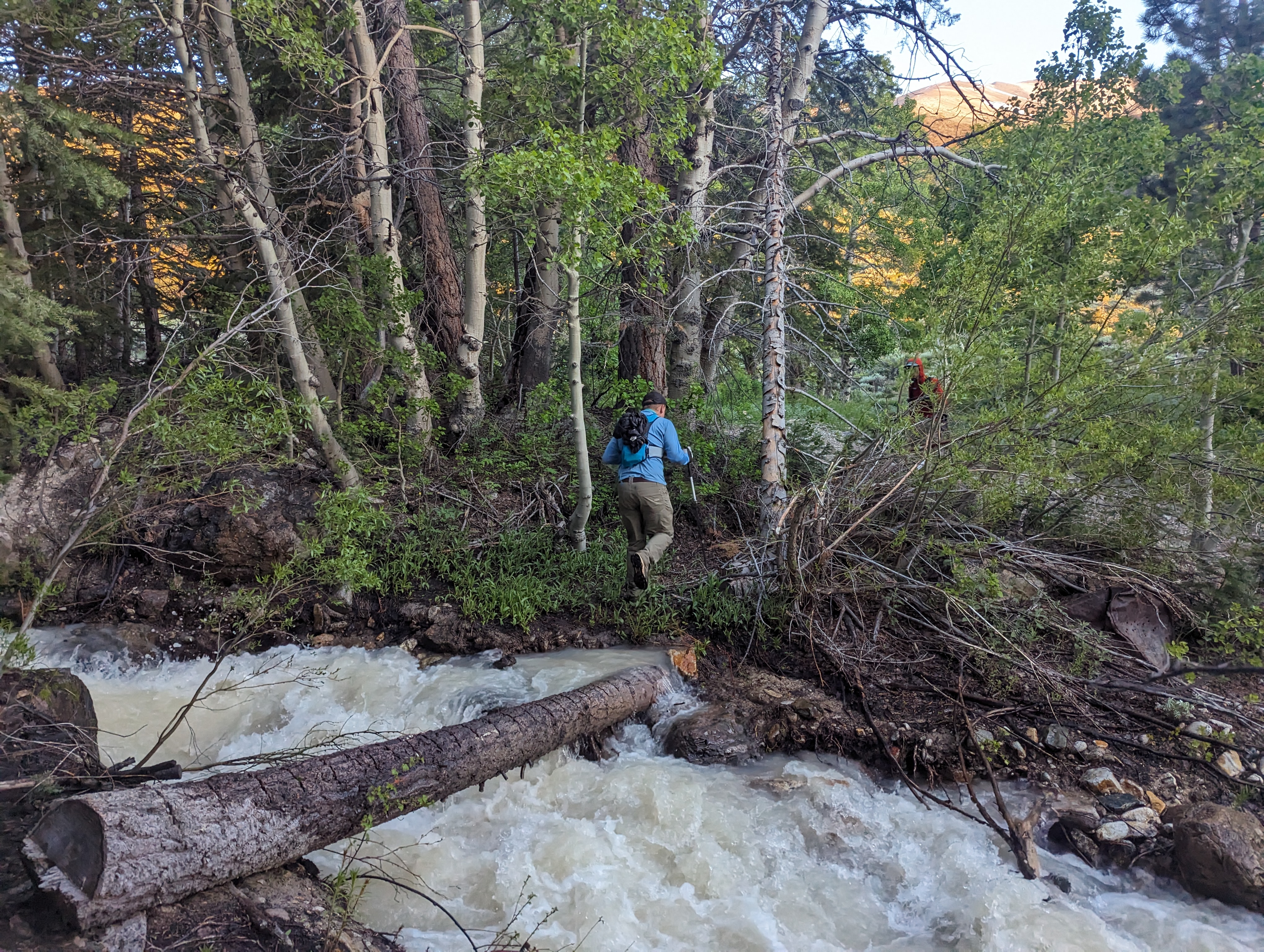
We immediately needed to cross the creek, which was raging pretty hard up there. Thankfully Chris and Jed spotted a crossing while I was still getting the last few things ready. We made it across the slightly slippery log without incident, and started walking up the road towards the top of the canyon. The road soon turned much more narrow, and made switchbacks up the steep canyon wall. At one point it seemed to fizzle out, and we realized that it was just a singletrack footpath beyond this point.
 Chris across the log crossing
From here, we traversed above the canyon floor, crossing a smaller creek about ¾ of a mile past the switchbacks. The trail was unmaintained, but still pretty easy to follow. We came across what must have been a small settlement soon after that, with bits of metal scattered about. Just beyond that were the ruins of another cabin, this one was in far worse shape than the Nugent Cabin.
 Looking up to the top of the canyon
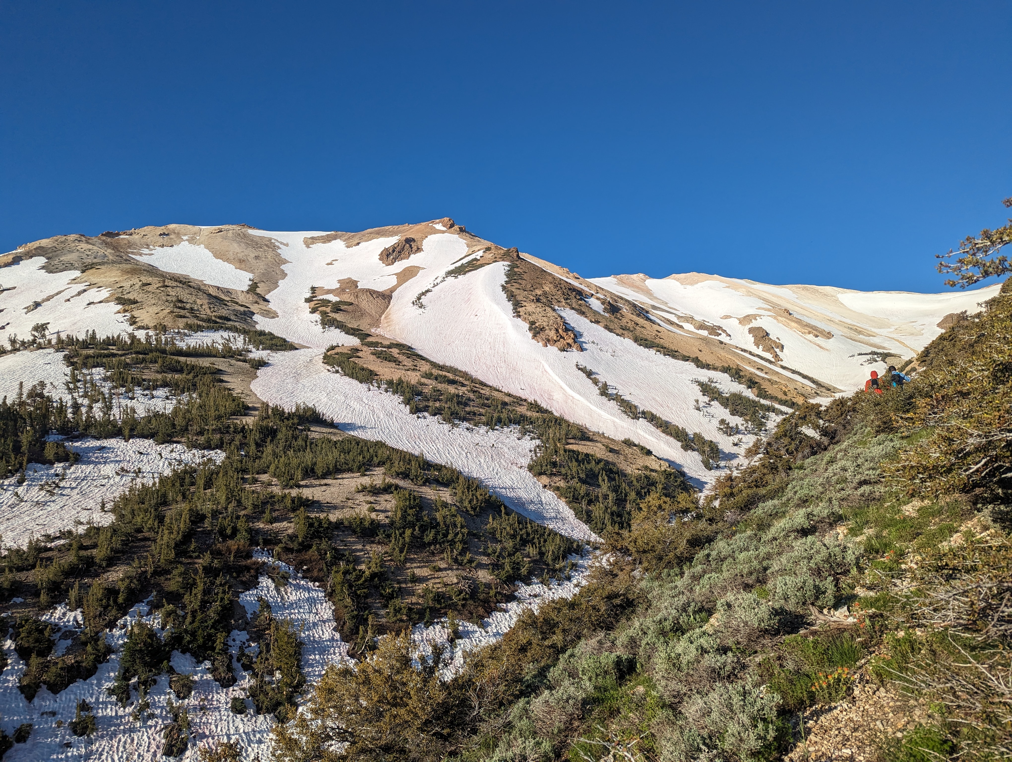
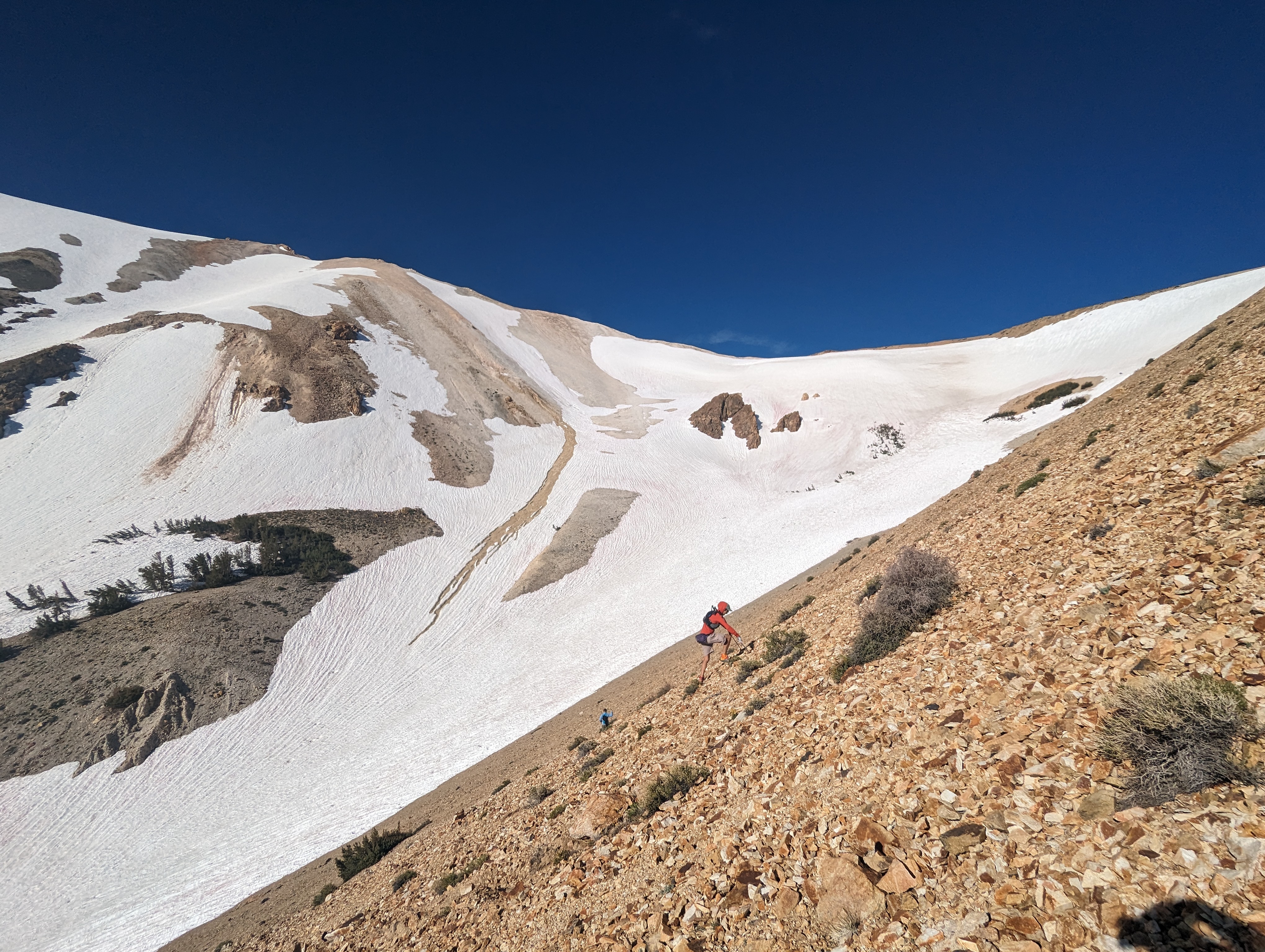
We slowly rounded the corner and were soon above the top section of the canyon, which was still mostly filled with snow at the bottom. We stayed high, and the trail became hard to follow, and then completely gone. From here we could see that we needed to get up a pretty steep scree field, which would put us pretty close to the summit. We all had different ideas of how to deal with the scree, Chris dropped to the canyon floor, and walked up as far as he could before going up. Jed cut at a roughly 45 degree angle, getting closer to the canyon mouth while still going up. I initially tried going straight up, but eventually ended up at an angle closer to Jeds.
 The steep climb up to the ridge
We all topped out within a few minutes of each other, none of the routes was very fun. Very much a 2 steps forward, 1 step back situation. I checked my CalTopo app and was delighted to see that we were at 10,900 feet. That meant we had roughly 800 vertical feet left to get to the summit, and nothing would be as steep for the rest of the day.
 Chris emerging from scree hell
From there we walked southwest until we came across a trail that led towards the summit. We stopped at a snow patch and put some snow into our hats to cool off. There was no shade up there, but the slight wind made the temperatures bearable. The trail was a pleasant walk, and it eventually linked up with a much larger road that cut straight up to the summit in a pretty steep fashion.
We got onto the road, and stopped to read the “Mars with Flowers” sign before it started its steep final push up Mt Patterson. It was relatively easy going from there to the summit. Just a steep road through the moonscape. We were all a bit out of breath, but moving pretty well. Before we knew it, we were on top of the Sweetwater range.
 Sign below the summit
We hung out for perhaps 20 minutes on the summit. Enjoying the views, and finding a weird assortment of items in the register box. Unfortunately this assortment didn’t include a register to sign. We did however find a properly folded American Flag, some bourbon, someone’s ORV registration, and some other odds and ends. I left my mark by putting a Lover’s Leap Guides sticker on the flagpole.
 Patterson Summit panorama
After our rest on the summit of Patterson, we continued along towards Wheeler, the second objective of the day. There seemed to be a road that went most of the way to Wheeler, just topping shy of the summit. We lumbered along downhill, crossing another fairly significant patch of snow. The road to Wheeler from there went up and down, but generally was fairly flat. After perhaps 20 or 30 minutes, we cut off from the road towards the summit of Wheeler. There were 2 peaks that could have been the summit. One was darker, and a bit closer, the other was lighter in color. We topped out on the darker one, only to realize that the other one was the summit. We hustled over to the lighter colored peak, and found the register and proper summit we had been looking for.
 Colorful rock on the way to Wheeler
I thought the views from Wheeler were perhaps a bit better than from Patterson. From here we could see the large network of roads cut into the side of Patterson, and a lot more of the moonscape. It’s a bit sad to see such a unique area torn up by mining, but it’s also very interesting to see. We again hung out for 20 minutes or so, taking some time to eat lunch. After that, we decided it was time to head back, and began retracing the route to Patterson.
 Summit panorama
The walk back was pretty easy, we made it back near the summit of Patterson, but didn’t go all the way back to the summit. We went back past the “Mars with Flowers” sign. We almost took the road a bit too far past the trail here, but we caught it and doubled back pretty quickly. We once again stopped at the patch of snow to fill our hats, and headed towards the steep scree field we had come up that morning. From here. It looked a lot steeper than when we had climbed it. Easily 45 degrees or steeper. Chris and I made a b-line straight down it, scree skiing side by side. We made it down in less than 5 minutes. Jed angled a bit down the canyon, before doing the same as Chris and I. We all reconvened at the snow, and opted to walk down the snow for as long as it seemed safe to do so. A few times we tried climbing out of the snow, but decided it was easier to just glissade down the snow.
 Walking back towards Patterson
 Back in the Canyon, still a hefty snowpack for July
Near the end of the good snow (free of sketchy looking snow bridges), Chris spotted a piece of machinery on the south side of the canyon. We made our way over to it, and found that it was some old mining machinery, probably an air compressor or water pump. There was a mine shaft right next to it, mostly filled with water. We spent a few minutes checking it all out and snapping some pics before moving on.
 The old mining equipment we found
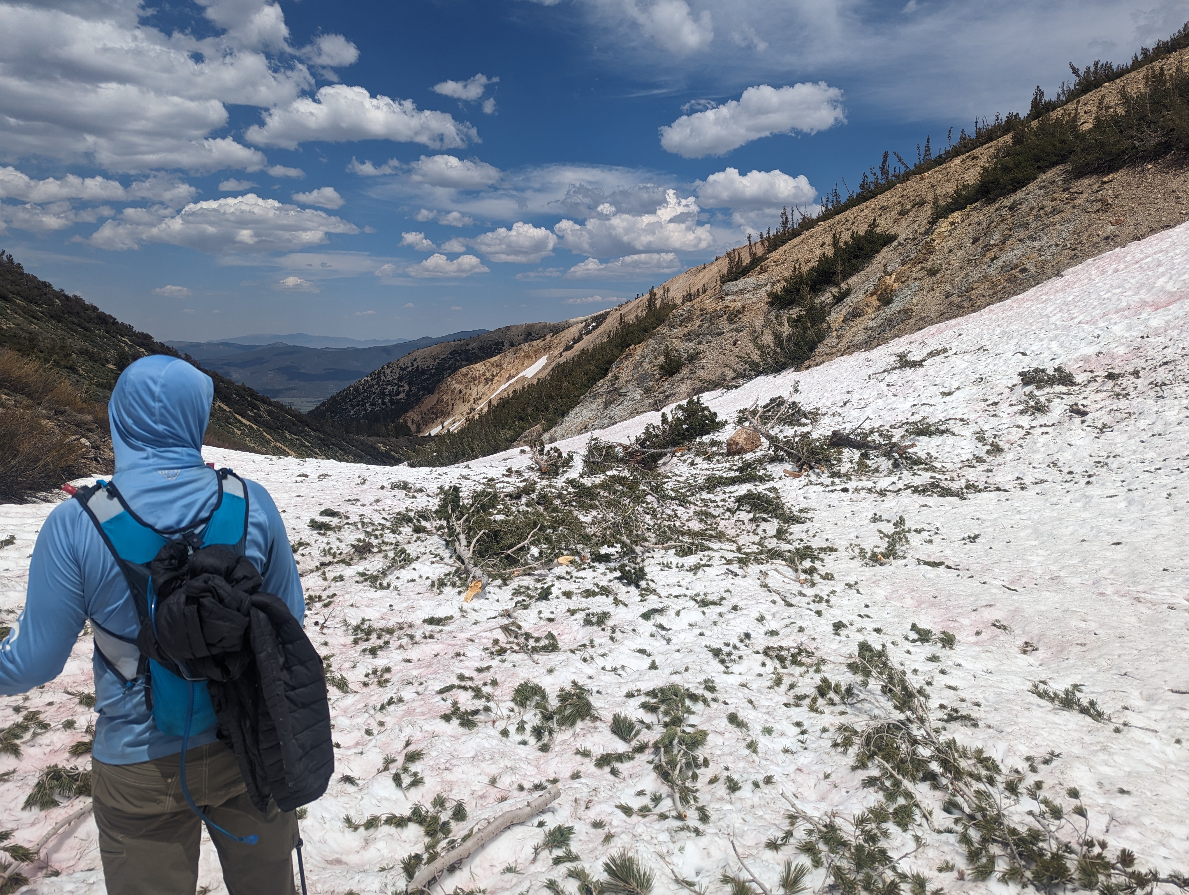 Avalanche Debris lower in the canyon
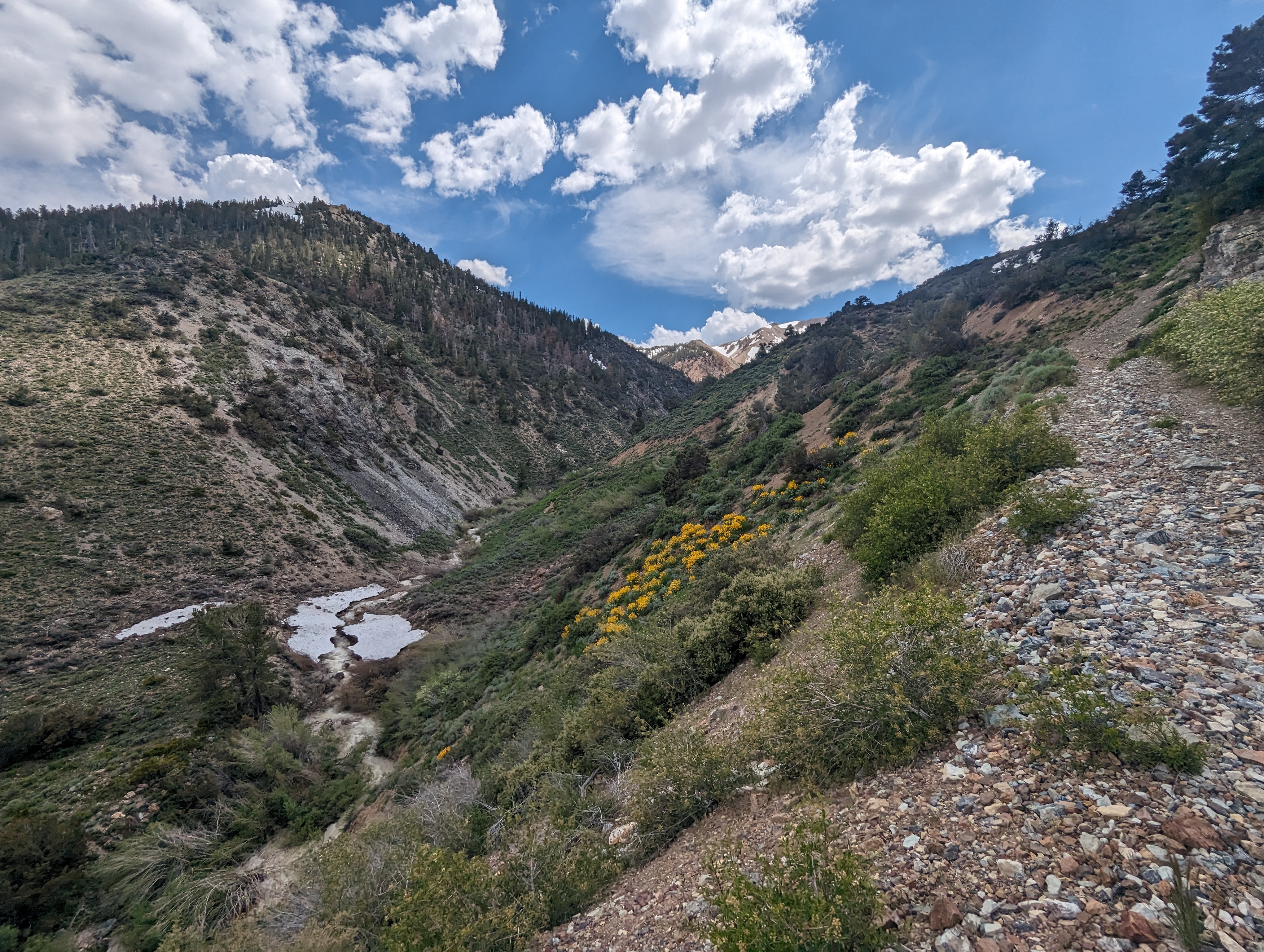
After the snow coverage got a bit thinner, we climbed back up the north side of the canyon, and reconvened with the trail. The walk back from there was pretty easy and pleasant. We stopped at one of the creeks we had crossed, and wet our hats and filled back up on water. We got back to the switchbacks, and back to the old doubletrack road. The last obstacle was the log crossing, and while the water was a good bit higher, we made it across safely. We loaded back up into my truck, and went back down the road. Once we had safely navigated all of the rocks, I was finally able to let my guard down. We spent one more night at the campsite before moving north the next day.
 Back on Doubletrack
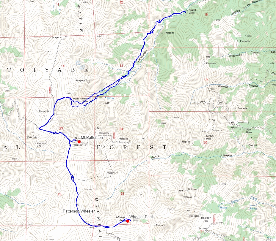
Route