OGUL #34 and 35 - Da-Ek-Dow Go-Et and The Nipple
July 4th, 2023
For our second stop on our peakbagging road trip, we camped on the side of Blue Lakes Road. Being the third of July, I was a bit pessimistic about finding a good place to camp, but we did end up finding a great place right by some running water. We woke up around 5 on the 4th and geared up for the day. We weren’t entirely sure about the snow, so we ended up bringing snowshoes just in case (we would later regret this decision).
Blue Lakes Road was closed 7 miles in, and we got to the road closure right around 6am and set off. The walk up the road was pretty easy, we passed some snow removal equipment not far from the start, despite a completely snow free road. Not too long after, we decided it would make sense to cut off the road to the left and up a small drainage. From there, we figured it would be a fairly simple ridge walk to the base of Da-Ek Dow Go-Et mountain.
The decision paid off, after a relatively easy section of cross country, we crested the ridge and the mountain came into view. We continued along towards it, and picked up a nice double track trail shortly thereafter. The mountain looked quite imposing, but we had done our research and I wasn’t too worried about it. After a few small ups and downs, we arrived at the base.
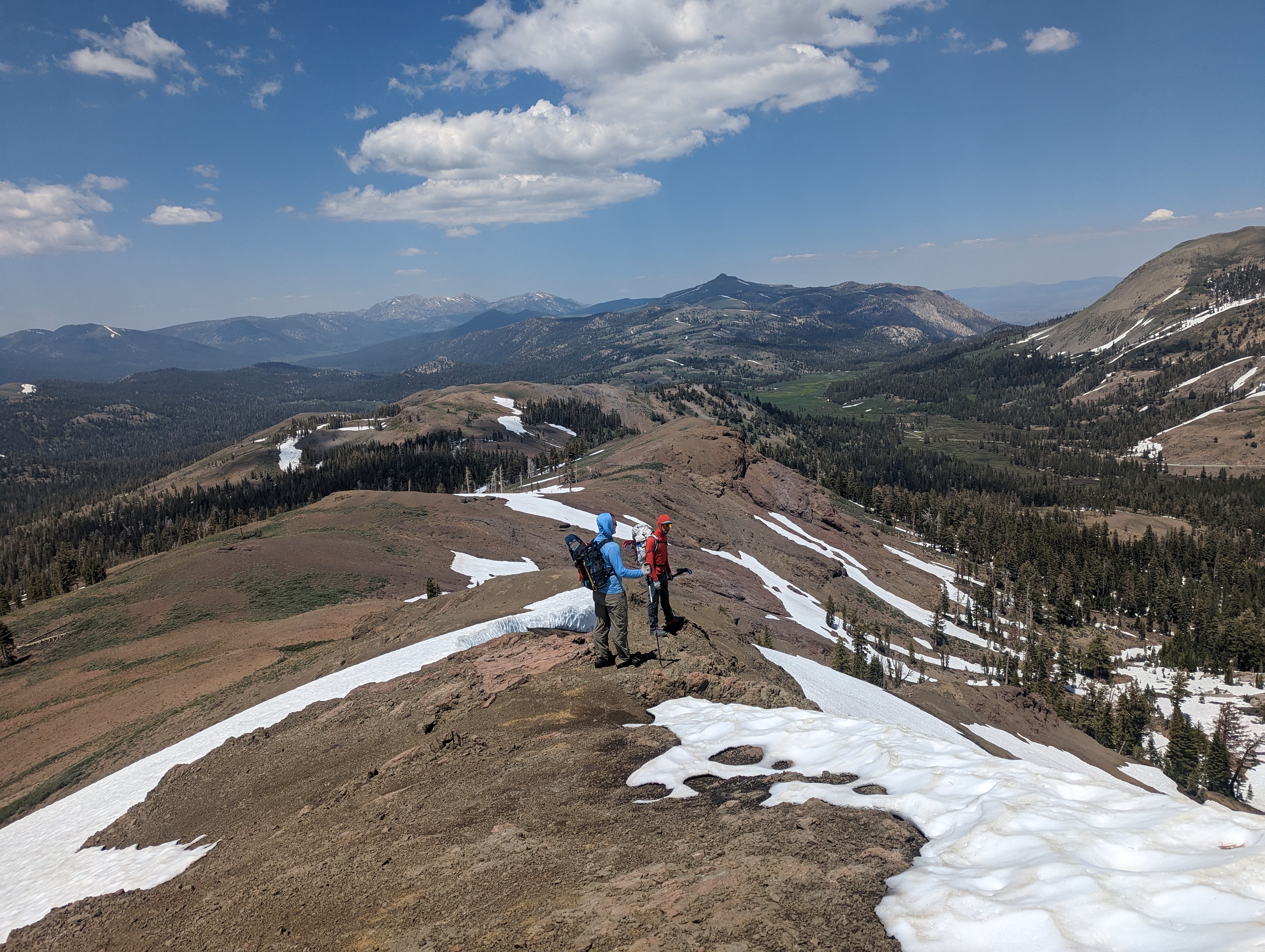
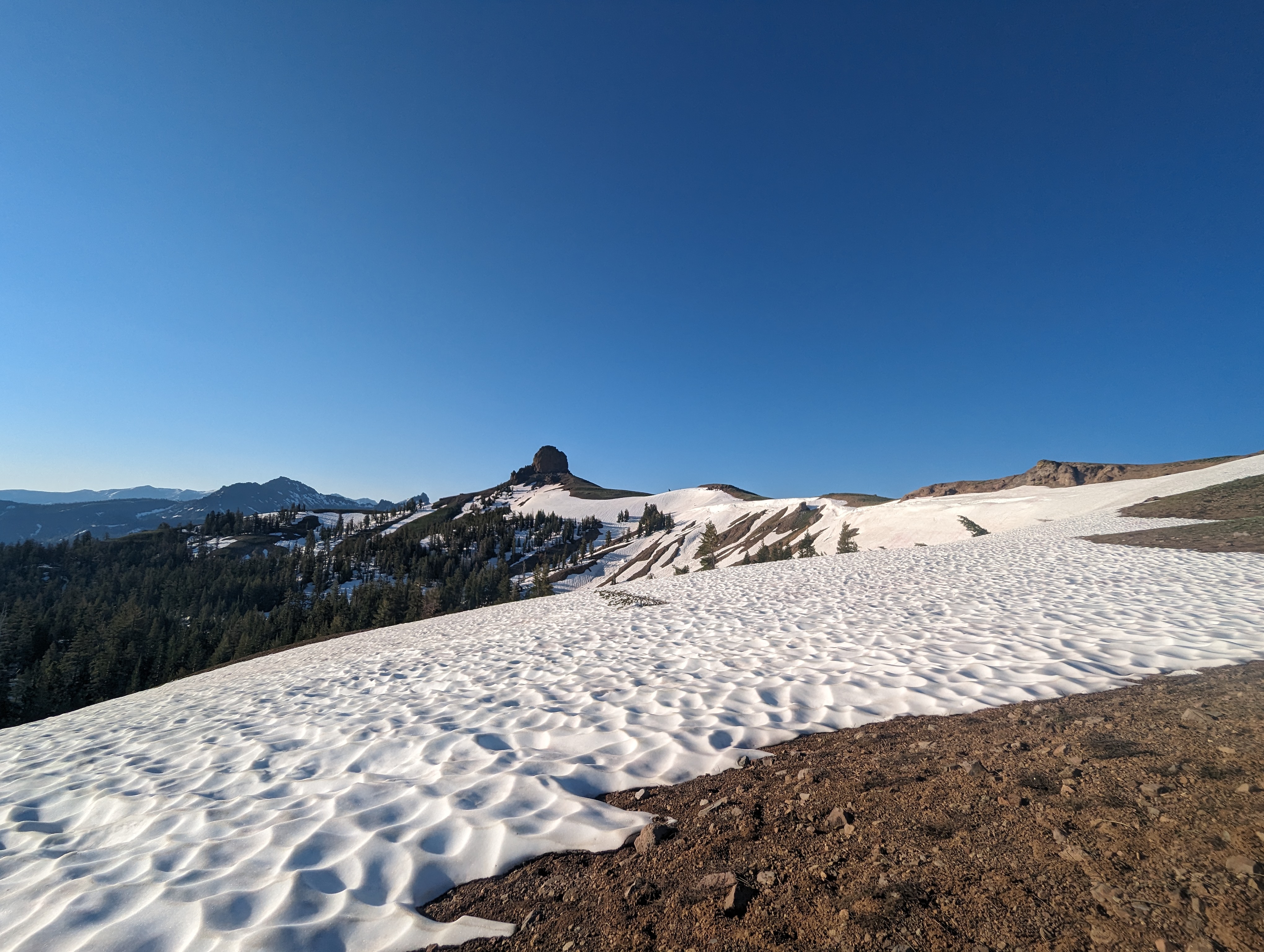 Our first objective comes into view
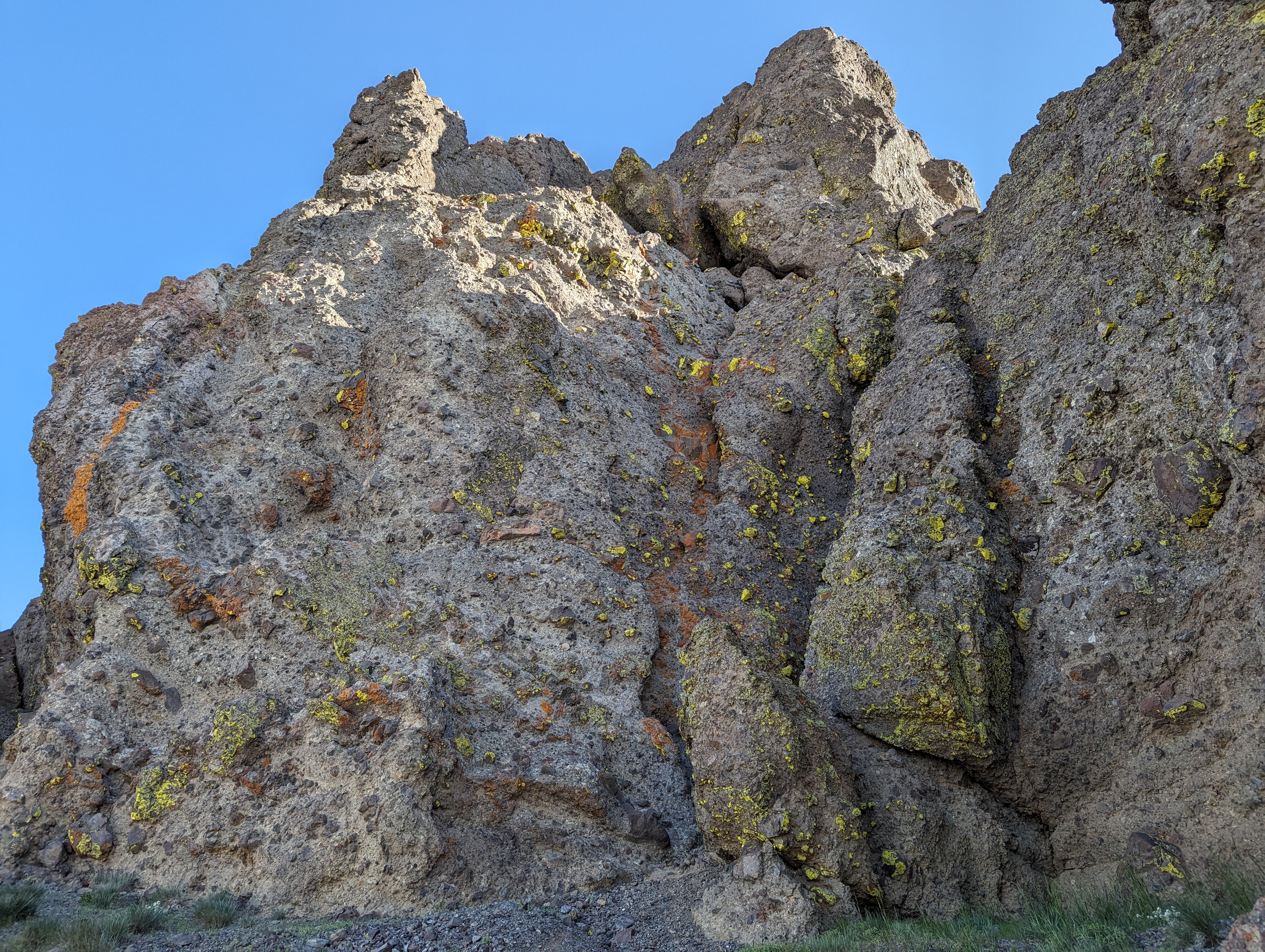
From there, we wrapped around to the southeast, traversing over some steep and loose volcanic rock. It was a bit of a precarious walk, the base was firm with small loose rocks covering the top. We figured out where the typical route was pretty quickly, and scrambled up some easy class 3 to get to the bottom of it.
Da-Ek Dow Go-Et was formerly named Jeff Davis Peak, which apparently was because of a group of Confederate sympathizers that were in the area in the 1800s. I don’t think mountains should be named after traitors, so I much prefer the Washoe name that has replaced it. It’s by far the most technical peak on the Ogul list, so I was glad to be getting it over with. It also is one of the more visually striking peaks on the list in my opinion.
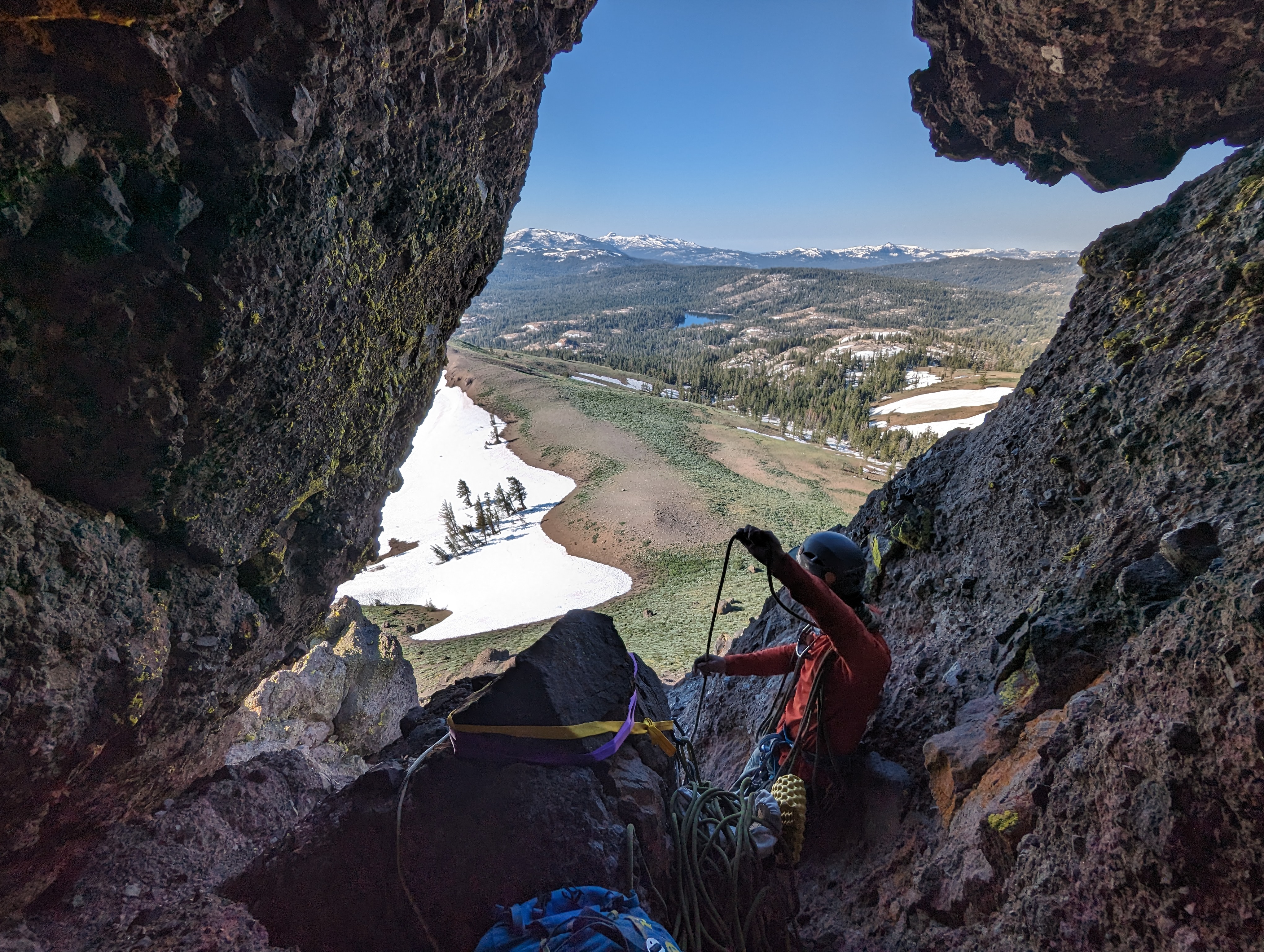
The plan was for Jed to solo up first (he’s a far stronger climber than Chris or myself), he would then sling a big rock up there, and belay Chris and myself. Jed handled the first pitch with ease, staying cool as a cucumber up the somewhat sketchy (yet technically easy) volcanic rock. Chris and I were waiting a good distance back, acutely aware of the high rockfall danger on this route. Jed called out “safe” when he got the anchor set up, and tossed the rope down.
 The first pitch we roped up for
I climbed next, the climb wasn’t very hard, but slightly scary due to the quality of the rock. I topped out the pitch in a few minutes, and climbed up behind Jed and the big chockstone that was used for the anchor. This was inside of a small cave that went further up the mountain at a fairly steep angle. Once I was situated, Jed tossed the rope down for Chris, who climbed up next. There was still a piece of webbing backed up by some cord here left by another party, so Jed was able to set the anchor up on that, using the 96” sling we brought to make things extra redundant. The belay area was cramped, but I was able to get comfortable behind the chockstone.
At this point, it was looking like the route would have to go out over some pretty big exposure, which made me a bit apprehensive for Jed to solo it. My neck was hurting from sleeping on it wrong the night before, so I was trying not to move it around too much. Thankfully I looked up the cave at one point and realized that I could see daylight through it. Memories of the trip reports I had read came flooding back, and I realized that the route went through there. We were all relieved by this. Once Chris was up, we took down the anchor and started shimmying up the cave.
 Jed belaying Chris up the first pitch
On top of the cave was a much flatter and larger belay station. The final pitch looked a lot more secure, a narrow chimney led up to the top. Jed tied into the rope, and I gave him a belay up. We weren’t sure what exactly the climb looked like above the chimney, so he planned to sling something part of the way up if needed. He got up the pitch easily again, and set up another anchor and tossed the rope down.
I climbed second again, and found the pitch to be a lot easier and more secure than the previous. No real exposure, and the holds were pretty secure. Once I got up, I got out of the way and fought the temptation to run up to the summit before Chris made it. Chris was up shortly, and we all went the last 20-30 feet up together.
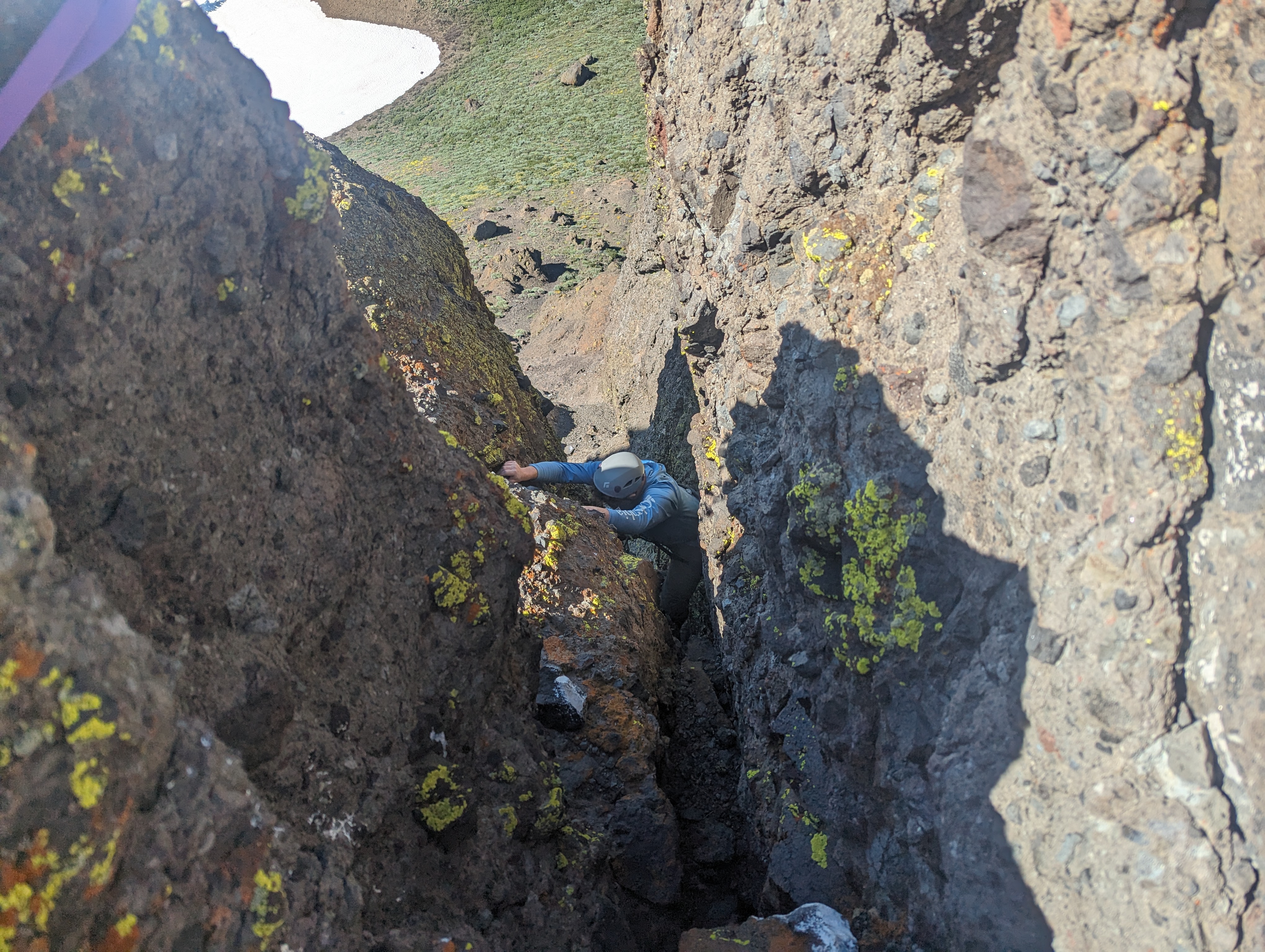 Chris coming up the chimney
The summit had great views of the surrounding areas, Raymond Peak and The Sinister looked particularly cool from this vantage. We probably spent a good 20 minutes on top enjoying the views and signing the register.
 Summit Panorama
On the way down, we opted to leave the 96” sling at the top for Jed to rap off of. He lowered Chris and myself off the first pitch before rapping down. We repeated the process down the bottom pitch, and soon were all at the base safely. We managed to all climb without falling or knocking anything down aside from a few small pebbles. In my opinion, 3 is a perfect number for this type of climb. I wouldn’t have wanted to do this with a much larger group due to the rockfall danger.
At the base we got our packs resituated, and retraced the ridge back to a large rock where we had stashed our snowshoes that morning. We wanted to stop for a snack break here, but saw some trees not far which would offer some shade. We made it down there, and enjoyed a nice break. A family with a dog walked by at one point, heading towards the ridge where we had come from.
Our next stop was The Nipple, which was a short distance across the road. The Nipple was still holding a good patch of snow near the peak, and we debated how direct of a line we wanted to take. We had snowshoes, but no crampons, and the top patch of snow looked possibly a bit steep for what we had. We ended up opting to go for the direct route, and started heading down towards the road.
After a short road walk, we cut back up towards the Nipple. We walked up a steep but mostly dry rib, seeing some nice ancient Junipers along the way. Just below the snowfield, we scrambled around a large rock outcropping. The snowfield looked steep, but manageable. There was a bit of risk if we slipped, but it didn’t look deadly. We kicked steps in our trail runners one by one, and managed the snow with ease.
 Weighing our route options going up The Nipple
From there, it was a simple but steep walk up chossy volcanic rock to the summit. We saw a group of deer very close to the summit, who weren’t very happy to see us and moved on their way in the opposite direction. Before long, we were at the top signing the register.
 Deer near the summit
The view from here was good, but probably not as good as from Da-Ek Dow Go-Et. At this point, we had another choice to make. We could either retrace our steps, or head down northeast directly towards my truck. We again opted for the more direct route.
 Summit Panorama
The walk down was steep, but mostly easy. We had to cross another steep and exposed patch of snow, but made it across with no issues. The wildflowers on this side of the mountain were spectacular. We stopped one more time on the way down to reapply sunscreen, and before long dropped off the ridge down directly towards my truck. After battling some marshy ground, we were at the meadow, where we found a dirt road leading back towards the truck. We got back to the truck around 3:30 and returned to our campsite. A short day as far as mileage goes, but a fun and rewarding one for sure.
 Heading back down towards Blue Lakes Road