OGUL #25 - Job's Peak
May 20th, 2023
My alarm woke me up from a weird dream at 2:40AM. I can’t recall the specifics of it at this point, but I do recall there being some weird tribal music, kind of similar to the “Survivor” theme song. I hadn’t slept that well, and had a moderately painful lump in my throat the week leading up. Despite my discomfort, I had been dreaming about this peak all week. I did my morning routine as quietly as possible, and left my comfortable bed, wife and dog behind. I love them dearly, but this is more than they want to do in a day.
I made a quick stop at Speedway in Placerville, and the 3AM tweakers were as active as they ever are. I grabbed a red bull, and some mini chocolate donuts to get my day started. I jammed up highway 50, and was at the trailhead around 4:40. After testing out the snow conditions and getting my gear ready, I was on the trail at 4:50. The trailhead was dry, but the snow started just a few feet behind the locked gate. I had my skis in an a-frame attached to my backpack, and opted to walk in my trail runners for as long as I could before switching over. I was a bit worried as the overnight temps were pretty high the night before, but I found the snow to still be supportive enough for walking.
Before long, I started to see the sun rise, and was able to take my headlamp off after about half an hour. I was able to maintain a pace of just above 2 miles per hour comfortably. The only complaint I had was that my splitboard setup was pretty heavy and seemed to be digging into my shoulders more than it usually does. I tried adjusting my backpack quite a few times to address this, but nothing seemed to fix it. For another hour or so, I was able to keep the same pace up with minimal post holing in the snow.
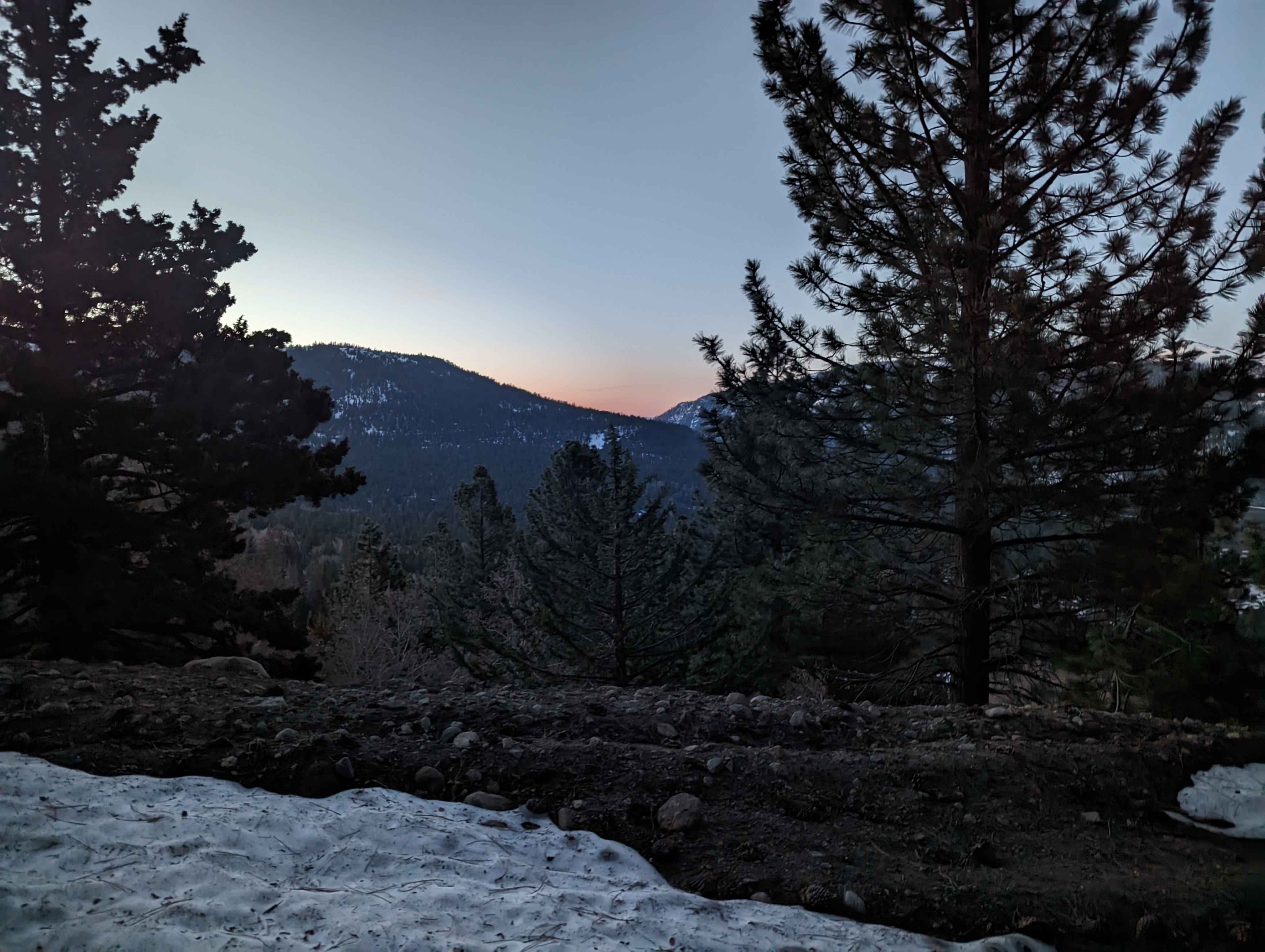 Starting to see the sun
The route follows Willow Creek Road up Horse Canyon, and once the road started getting closer to the creek, the snow seemed to firm up even more. This was great, but I did end up finding a few sections of road that required me to side hill in slippery snow due to the way it had melted more on one side than the other. I did end up losing the route at one point where there was a fairly large opening, I had to check my map several times, and ultimately corrected it within about 20 minutes and got back on the road.
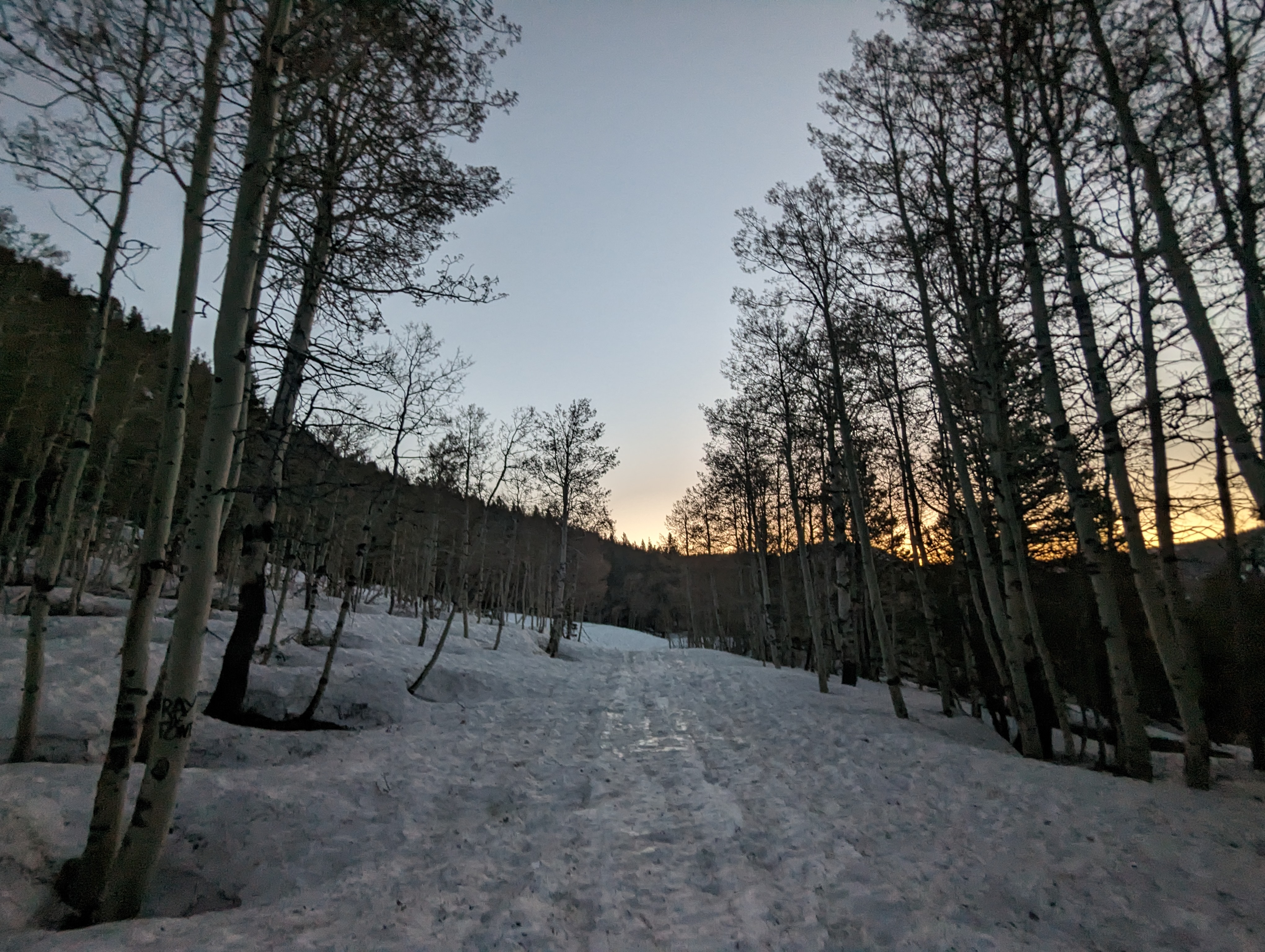 Grove of aspens a mile or 2 in
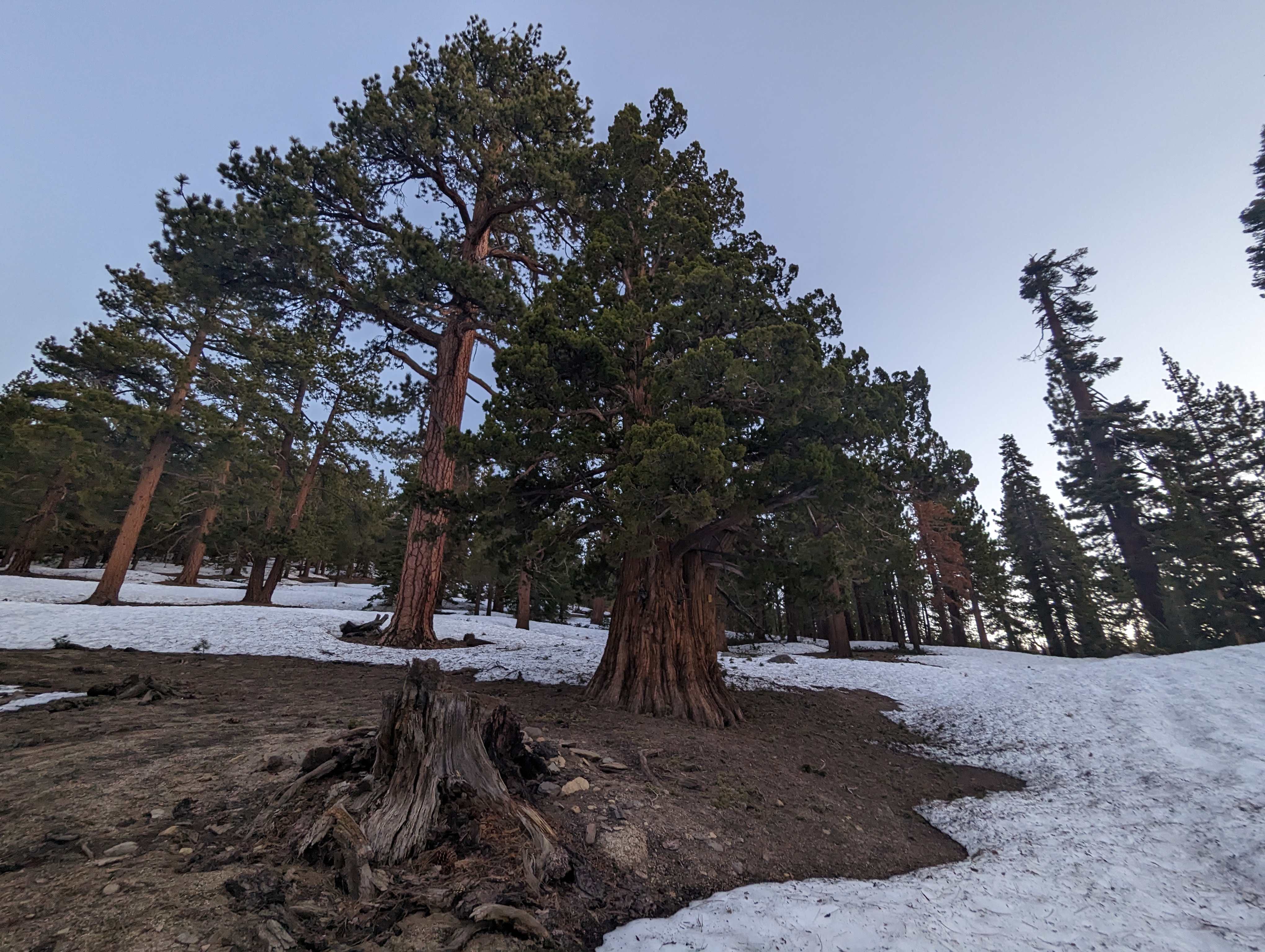 Another healthy looking forest in Horse Canyon
 Looking up towards Freel Peak, El Dorado County’s highpoint
Before I knew it, I had knocked out nearly 5 miles, and the road had ended. At this point I tried my best to start following the summer trail up Job’s. This was quite a bit steeper than the road, but I was still finding my shoes to do the job. The snow got softer as I went up, and my feet and socks were already fairly wet at this point (I always carry 2 pairs for this reason). I just resigned to a bit more postholing, and continued up with moderately cold feet. I veered a bit off of the summer trail, but its not like there’s much difference when its all snow covered. The trees started to get more alpine looking and windswept as I continued my way up. Eventually, the last saddle below Job’s started to come into view.
 Looking back down the slope towards Horse Canyon
I was still about a half mile away when the snow started forming a very slick crust on top. I was able to kick steps in most of the time, but eventually the shady spots became too difficult to kick into, and I started slipping. I found a nice tree to sit next to, and swapped into dry socks and my ski boots. It felt good to have the weight of the boots off of my back, but I immediately felt the strain of the added weight on my feet. This stretch was by far the most exhausting part of the day, my legs just did not want to be swinging my heavy ski boots up the steepish slope. I settled into my slower pace, and before too long, I started to see the snow disappear near the top of the ridge and give way to decomposed granite. This was arguably harder than the snow, but only lasted for a hundred yards or so.
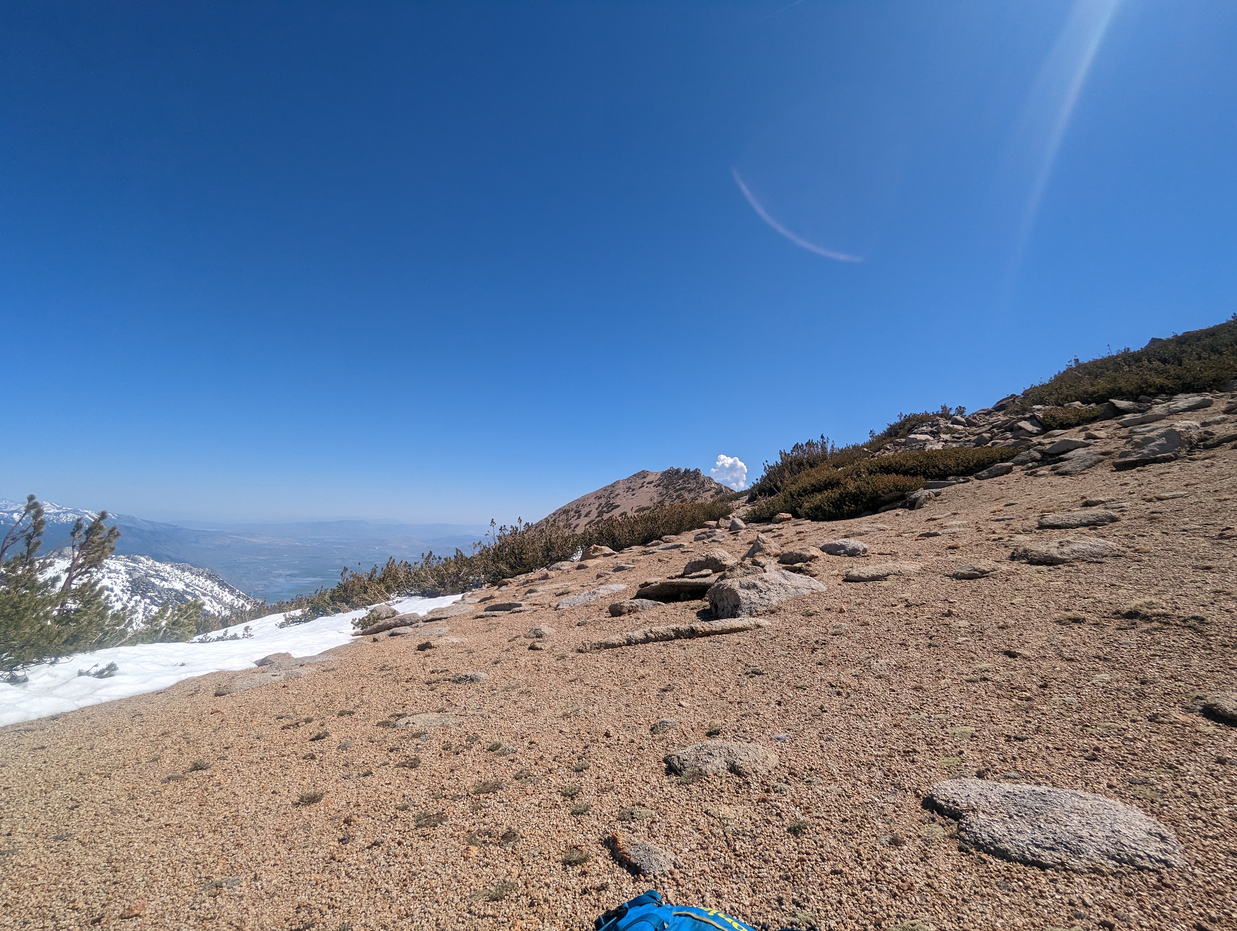
I still couldn’t quite see the peak from here, but after rounding a corner, it came into view, along with a lot of the Carson Valley. I took my phone out of airplane mode, and sent a quick text to my wife as I sat down and switched back over to wet socks and trail runners. The summer trail to the peak was mostly dry from here, save for one large snowfield that looked manageable in shoes. I left as much gear behind a possible to lighten my load, including the splitboard setup and my larger water bottle. The snowfield crossing was manageable, but the postholing was atrocious. Some steps I hardly punched through, and others were thigh deep. I despise spring post holing, its extremely frustrating and can definitely be dangerous. Regardless, I persevered and made it across the snowfield pretty quick, opting to gain some elevation so I could rock hop near the end.
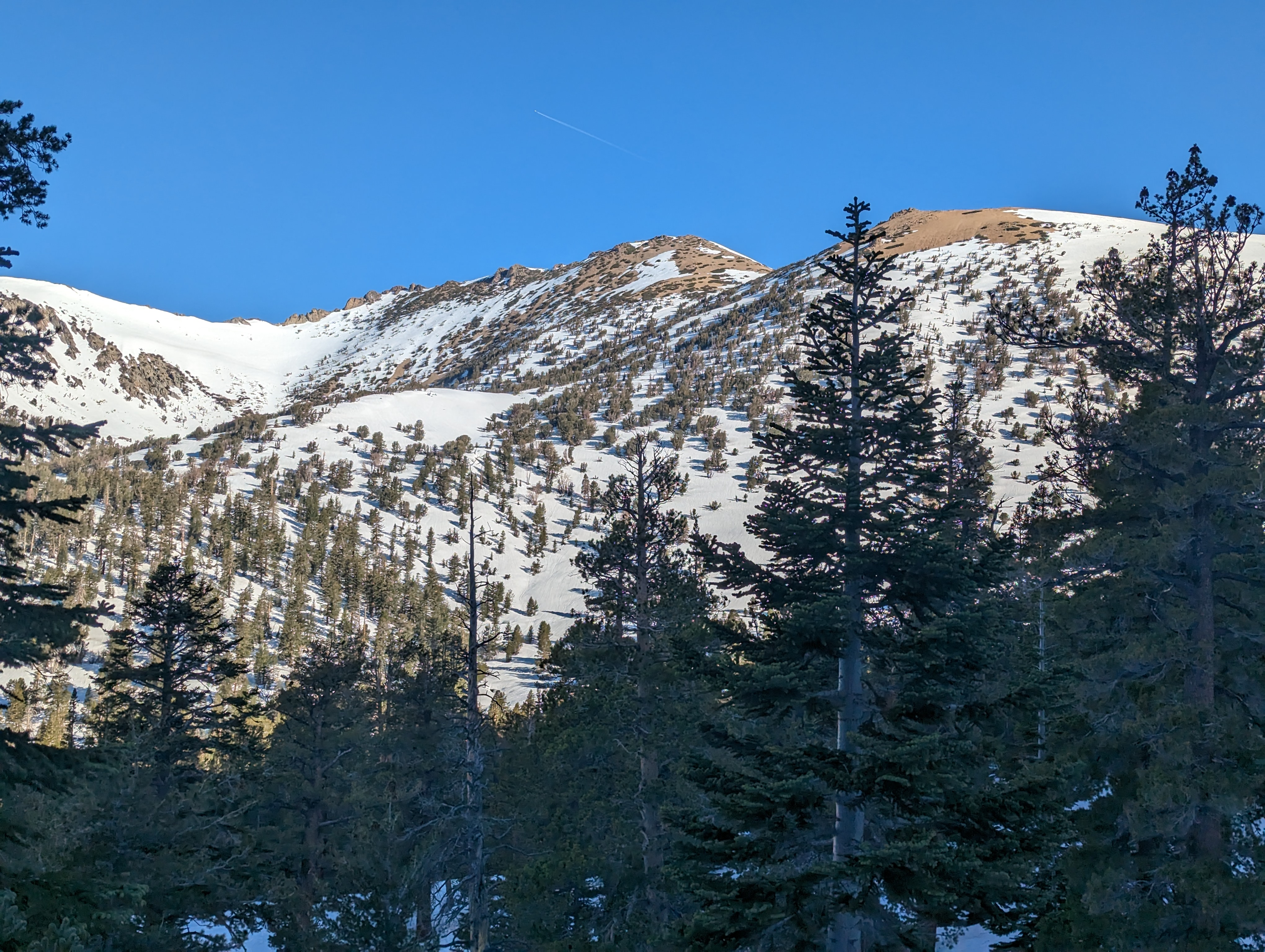
 The summit coming into view
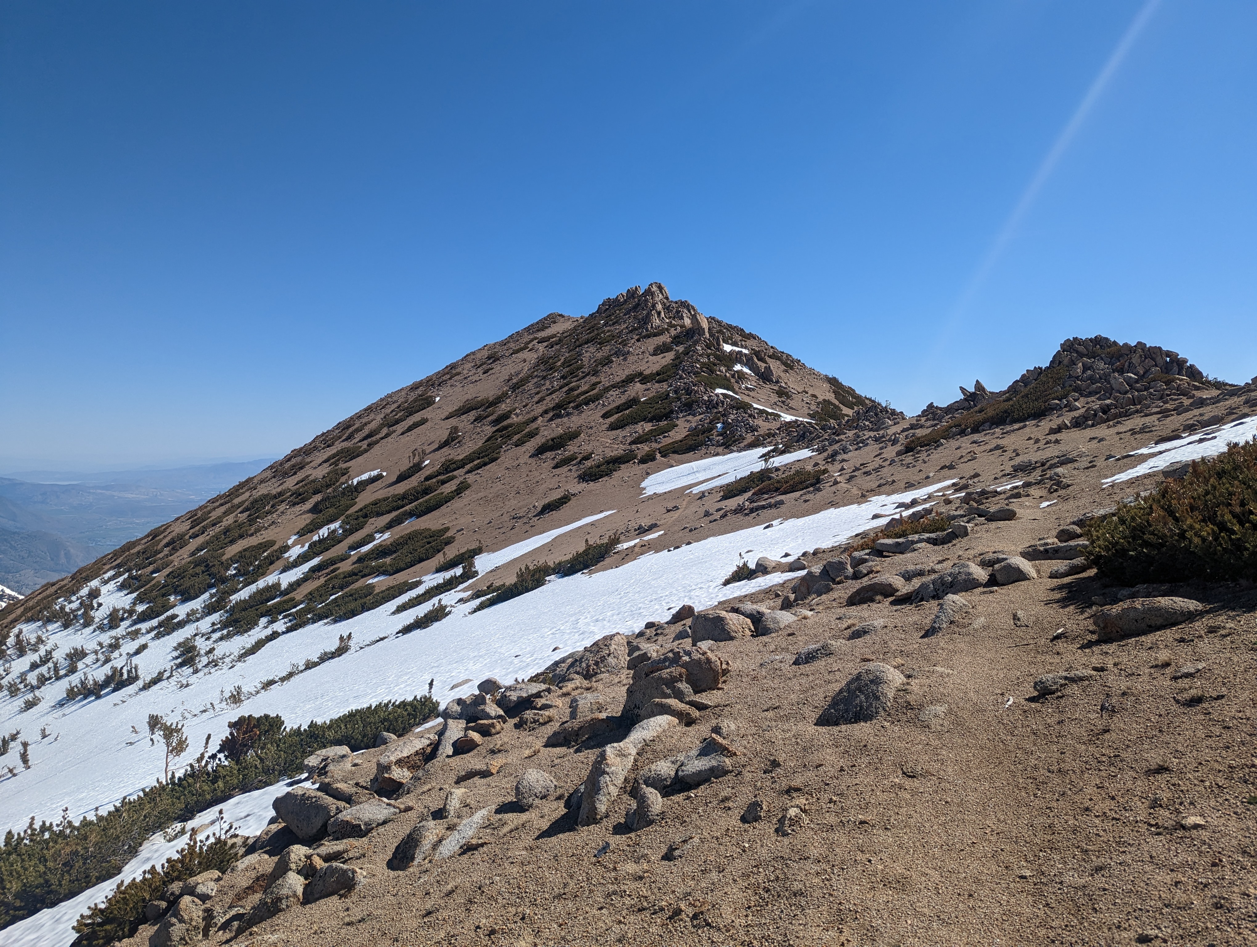 Nearing the summit triangle
From here, I was about 300 vertical feet shy of the summit on a dry trail. I made relatively quick work of it, although I was definitely getting pretty gassed from the miles and altitude. The trail snaked along the side of the summit triangle, and as I got closer, I wasn’t quite sure which part was the summit as there were 2 distinct rock outcroppings near the top. As it turned out, the summit was to my right, and that became obvious as I came between the 2 points. The scramble to the very top wasn’t nearly as long as I had anticipated, and I topped out right at 10AM.
 Panorama from the top
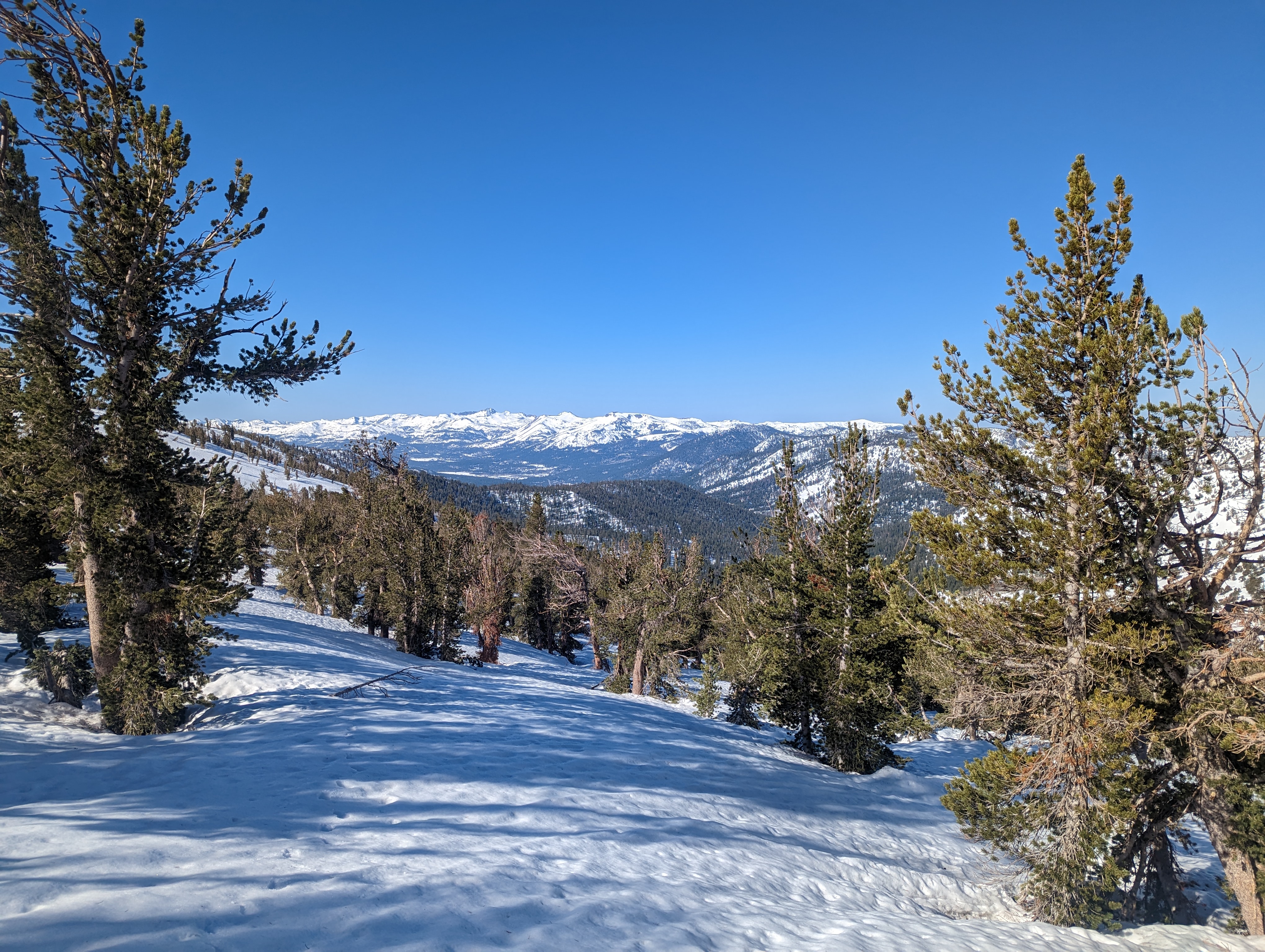
 Job’s Sister and Freel Peak, another fantastic hike in the area
I took a handful of pictures, and texted my wife from the top in addition to just soaking in the views. The roast beef sandwich I packed was absolutely delicious, and went great with some cheddar Sun Chips. I probably spent 20-30 minutes on top enjoying a hard earned lunch with a fantastic view. It was pretty cool looking down at the Wade Benchmark I had climbed the week before, along with all of the growing list of peaks in the area I can recognize. I still had a long trip back, and the snow was softening up quickly, so I decided to head back down.
 Lunch with a view
The return trip across the snowfield was a bit easier as I was able to just reuse the steps I had made before. The places where I had postholed deep were definitely a pain to step over though. I made it back to my gear I had dropped, and once again switched back into dry socks and ski boots. After putting my splitboard together, and packing up my gear, I made the brief walk down the decomposed granite to the snow.
The snow was very soft, and it was more of survival boarding through the trees than anything glamorous or fast. I still had a good time, and was back down in the valley in short order. Down there, I started hearing the sound of 2 strong engines, and figured there must have been some snowmobilers in the area. After switching over to skis, the snowmobilers got closer and I saw them ripping through the trees. One stopped and we exchanged a quick wave, I was glad they were at least aware of my presence. I skied down through some trees, and soon was back on the road. It was baking hot down there, and I started needing to drink a lot more water.
 Looking back at Job from Horse Canyon
The next few miles were relatively uneventful, but I did start to notice I was running low on water. I saw a creek crossing not far ahead on the map, so held off until then. At the crossing, I realized I was on top of a wooden bridge (perhaps 6 feet above it on snow though), I had missed this when I lost the road that morning. I took my skis off, and brought my water bottle down to the creek. While trying to find a good way down to the snow, I broke off a big chunk of snow, and fell into the creek about knee deep. At least you know its an adventure when things start going wrong! In addition, I realized I didn’t have a filter, and the water had a bit more particulate than I cared for. It was all snowmelt, and the particulate was probably just forest duff that the creek picked up, but I was not stoked to drink it. I grabbed my spare base layer shirt from my backpack, and used that as a “filter” as I drank it for the rest of the trip. Thankfully my boots were wet, but it wasn’t cold enough for me to be concerned.
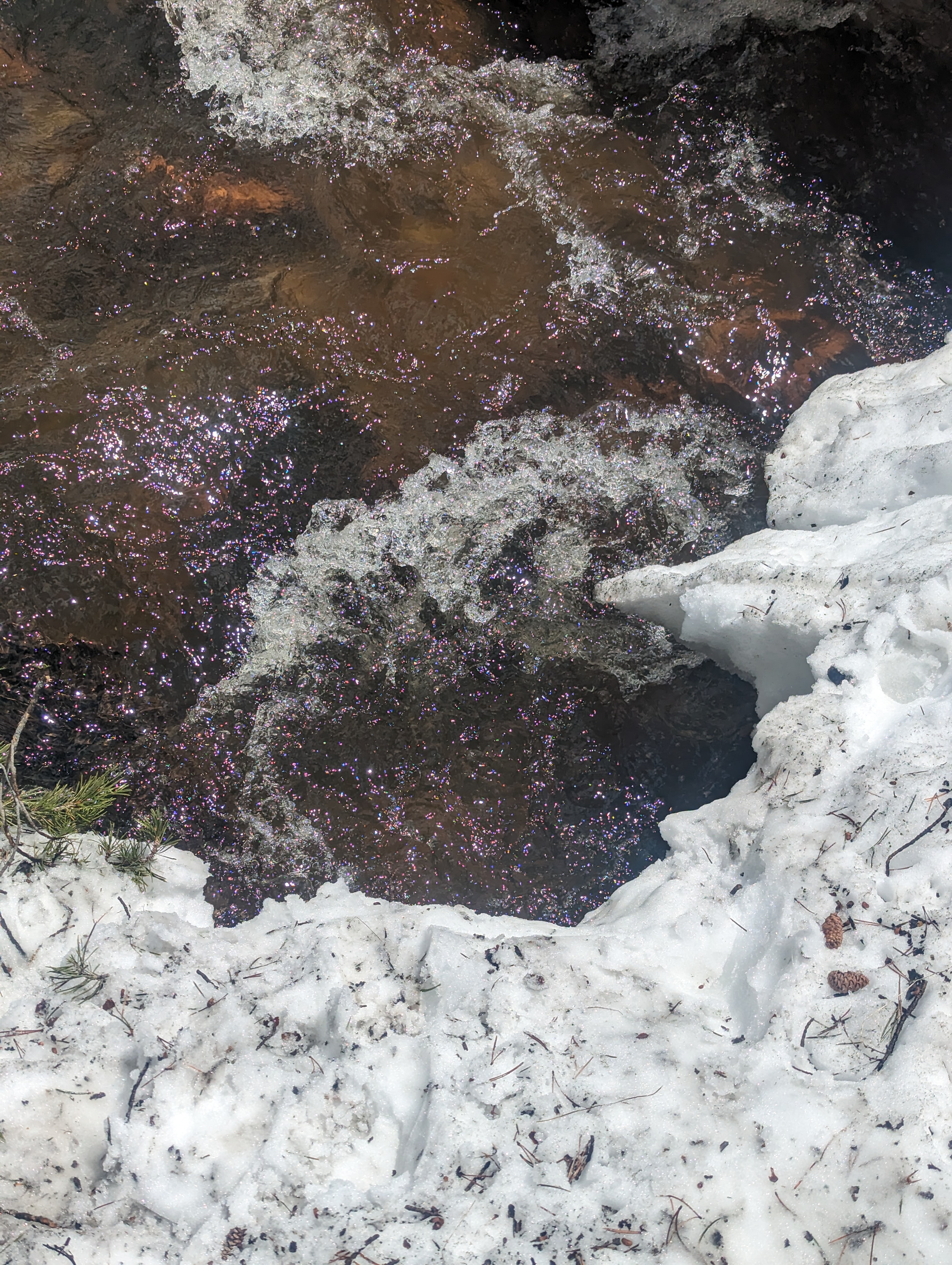 The spot where I punched through into the creek
After leaving the creek, I made a wrong turn and somehow almost took the wrong drainage all the way down to hope valley, several miles below where I was parked. Realizing my mistake, I had to trudge back uphill for about a quarter mile. I had made it this far without using skins, and really didn’t want to put them on now. So I made extra switchbacks, and the slushy snow somehow allowed me to barely eek out some uphill travel without skins. Eventually I got back on the road, and enjoyed being able to glide back down to the car with minimal stops. Down towards the bottom, it got a bit patchy, but I made it back to the car around 1:30PM. I was wet and tired, but beyond happy to see the car. All told, it was about a 15 mile round trip. Right as I made it to the car, I started hearing the first thunder I heard all day, perfect timing.
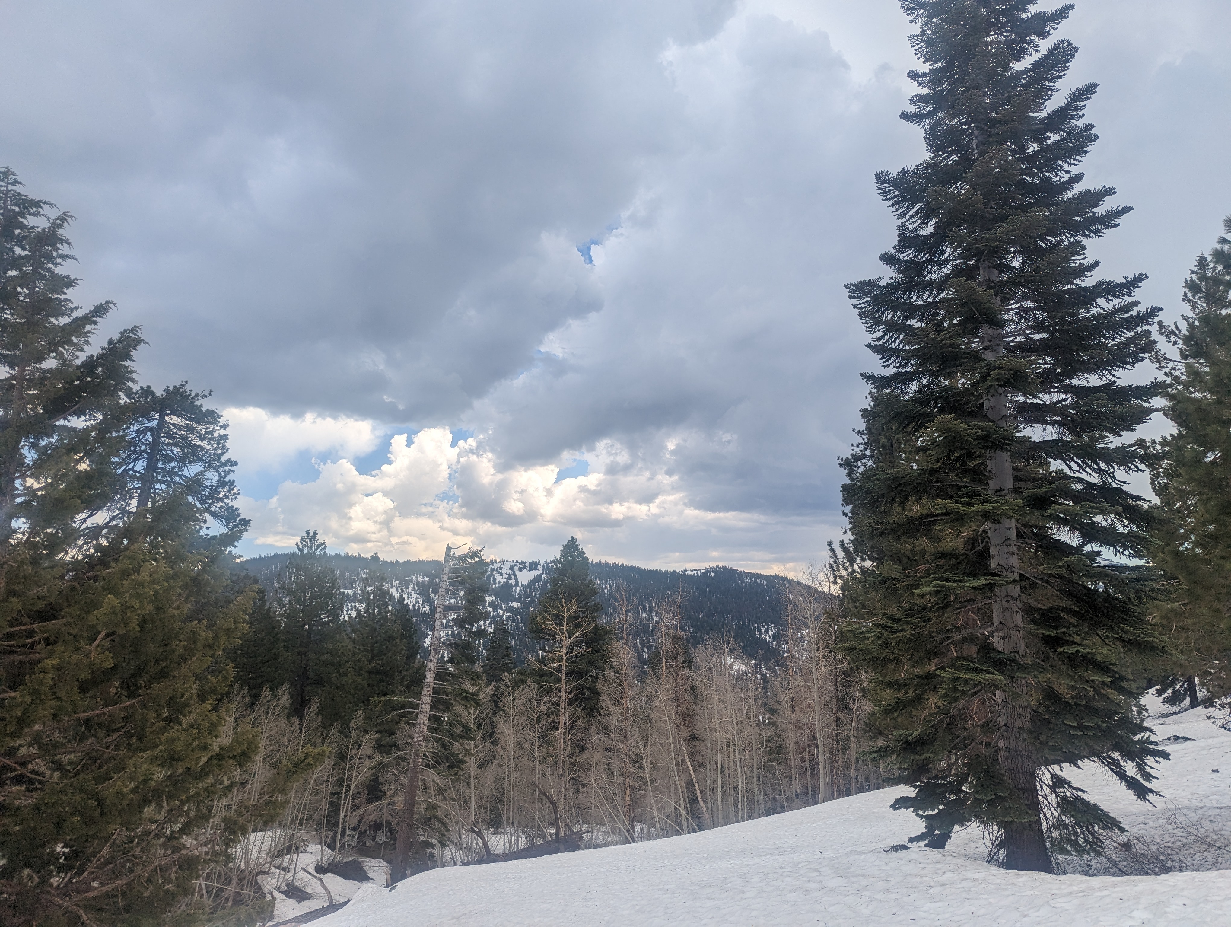 Storm clouds forming near the end
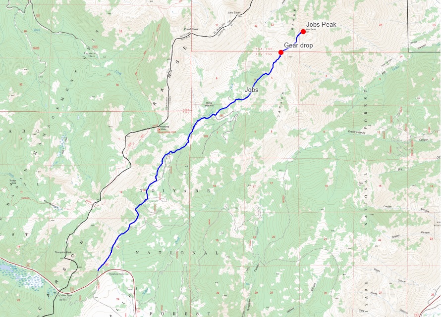
Route
* Only ascent route is shown as I turned off gps to save battery on the return *