OGUL #29 - Mt Siegel
May 29th, 2023
I woke up at my campsite near Sonora Pass right around 4:40AM. It was 20 minutes before my alarm, but the desert birds had started their morning routine already. This was my third morning out there, and I knew that this meant the sun was coming up soon. I felt rested so I forced myself out of my down quilt, and started packing my truck up. I quickly broke camp and threw everything in my truck, on the road towards Gardnerville shortly after 5. The drive went by quickly, and I went straight to the Walmart there to grab some food for my excursion.
After leaving Walmart, I headed down Lone Pine Canyon Road, figuring I’d go as far as I felt comfortable going with my truck. There are various reports on this road on peakbagger.com, with varying accounts of how difficult the road is. One person suggested airing down your tires a few miles in (not really an option without a compressor), and others claimed to have made it to the Galena Saddle, just shy of the peak in stock 4runners and Tacomas. The road was just a normal dirt road for the first few miles. but around the area where the person suggested airing down it had a ton of rocks on the road. I understood why he suggested that, but wasn’t too worried about my tires yet. I made one fairly deep creek crossing, and encountered some pretty deep mud and ruts along the next few miles. At one point, I bottomed my truck out on a big rock, which made me wince pretty hard. I got out and checked the underside of my truck, and nothing seemed damaged, so I kept going. Eventually the mud got more consistent, as well as the deep ruts that required you to straddle to avoid getting stuck. I told myself I’d use the next good pullout to park and just walk from there.
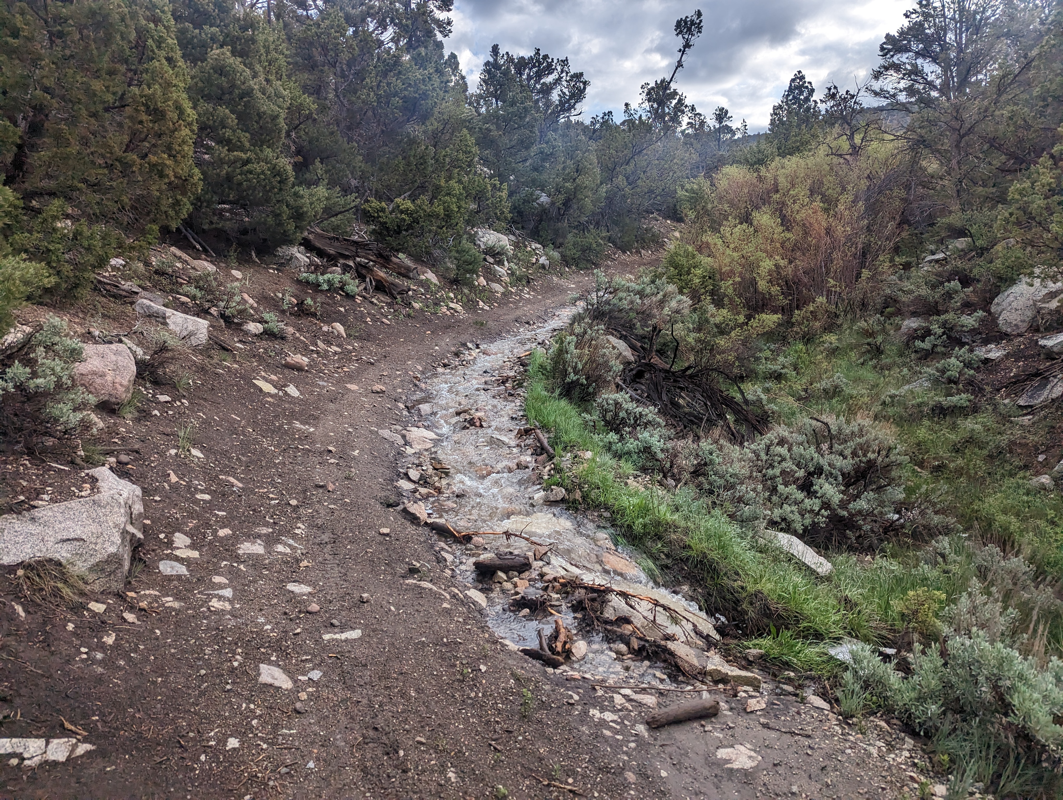 The road not long after I parked
I found a good place to park, and got my stuff ready to go. My plan was to hit this fast and light, I wanted to get done early so I could make it down Highway 50 before too much Memorial Day traffic formed near Meyers as it often does. The parking spot was somewhere around 1.5 miles from the start of the ridge that leads up to Mt Siegel that I planned to take up. This section of road was easy enough to walk, but I was glad to have left my truck behind. There were a few spots where I had to jump across sections of water in the road, and for a few hundred feet the road became more of a creek. Near the ridge, some very deep ruts had formed that I would definitely not have wanted to attempt in my truck.
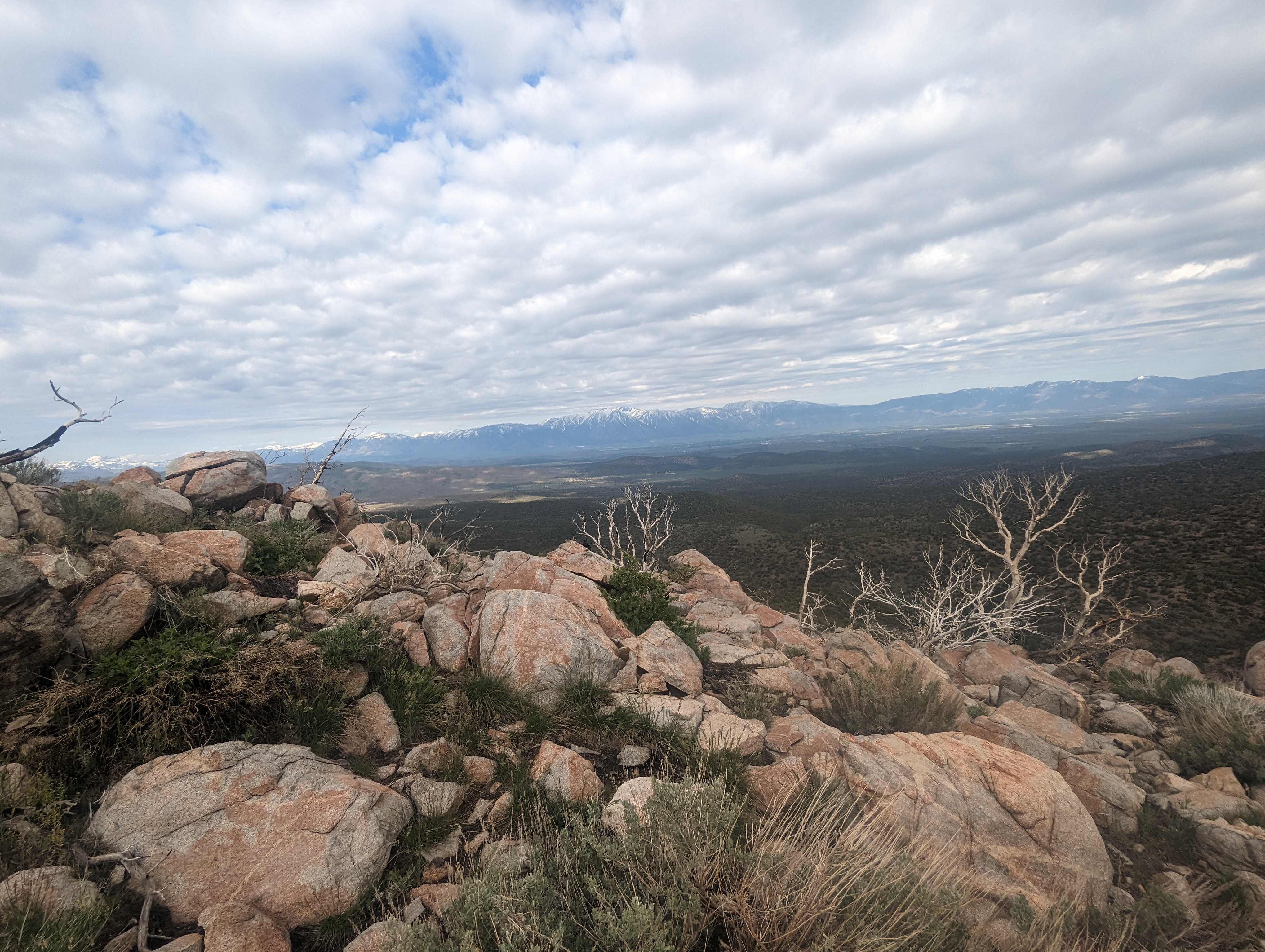
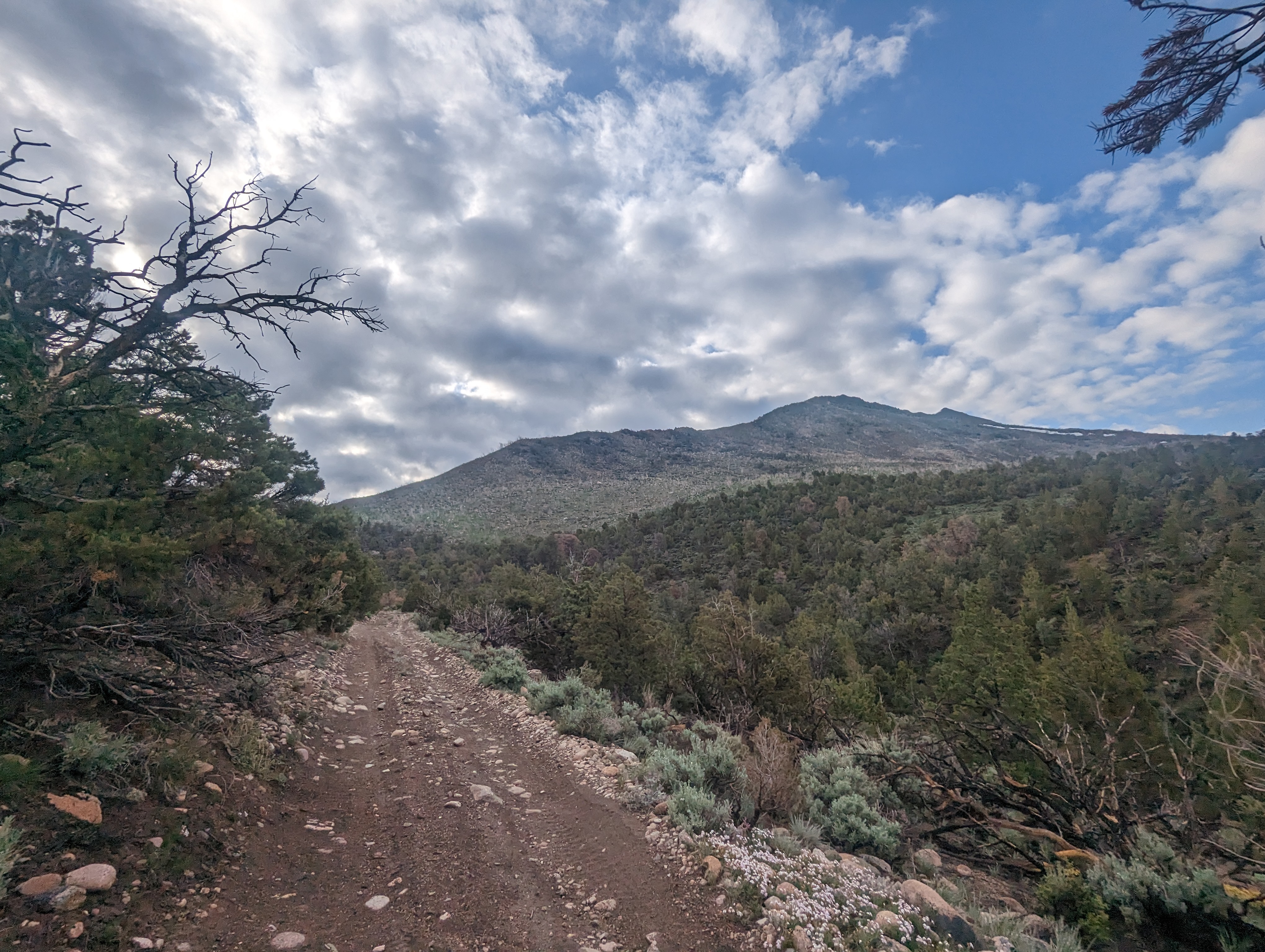 Mt Siegel’s Ridge
Before too long, I started cutting up from the road to the ridge, immediately soaking my feet in the dew-covered tall grass. There was a pretty significant fire here a few years back, so there was a mix of dead trees and a fairly vibrant selection of shrubs, grasses and flowers. A part of me is always bummed to see an area burned so badly, but its also reassuring to see how quickly things restore. Fire is after all just part of the cycle in places like this. I’m sure this was neither the first nor last fire in this area.
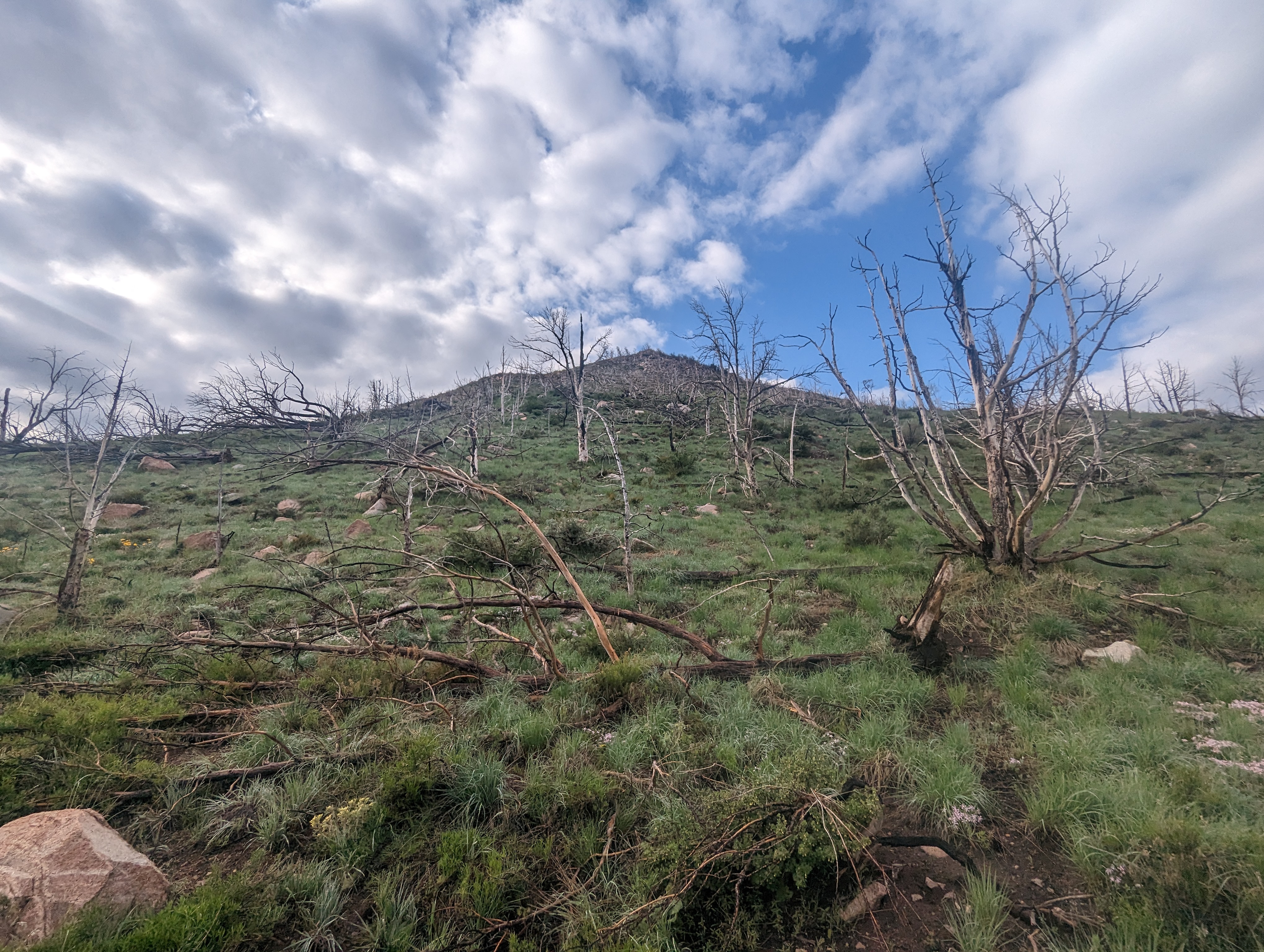 Wet grass on the bottom of the ridge
After a light bushwhack, I started up the beginning of the ridge proper. This was one of the steepest sections of the ridge all day, mostly medium sized light colored granite with tree carcasses and shrubs among it. The climb would consist of many sections of steeper ridge leading to brief sections where it flattened out. I put my focus on making it up the first such section and was there before too long. The view from up there was pretty nice towards Job’s Peak from the previous weekend.
 Job’s Peak in the distance
From here, the angle was a bit lighter for a good distance before the next high point on the ridge, and the ratio of vegetation to rock started to lean more in favor of rock. I kept moving pretty consistently here, stopping occasionally to snap a picture and catch my breath. The weather was overcast which I was grateful for, this peak must be brutal in the heat of summer with direct sunlight. Looking back I could clearly see where the fire had stopped, creating a stark contrast between the green forest and the recovering shrubs. My route followed the ridge up to point 8595, and I stopped again for a quick snack break and to check my progress on the map.
 Looking up from near point 8595
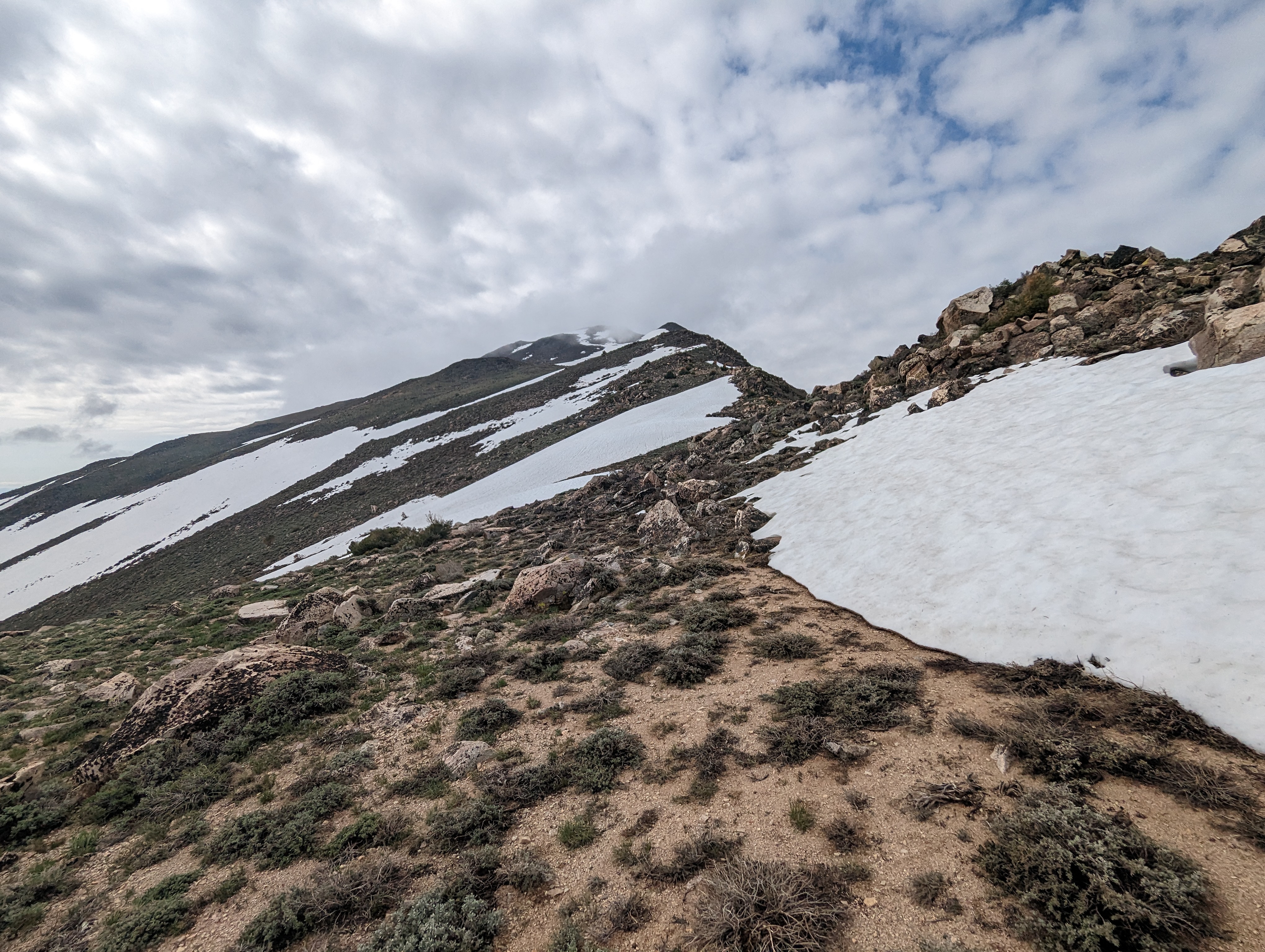
Making it to the next bump in the ridge looked like it would require crossing at least a small section of snow, so I tried to aim for the shortest possible crossing. The climb up to this point started to feel a lot more alpine. The chunks of granite became generally a lot larger and the slope was steeper. That said, I found the larger pieces of granite to be more stable and easier to hop across, this is one of my favorite types of terrain to travel through. I managed to find about the shortest section of snow possible to cross, and was soon on point 9354, just a few hundred vertical feet below Siegel, but with a decent distance left.
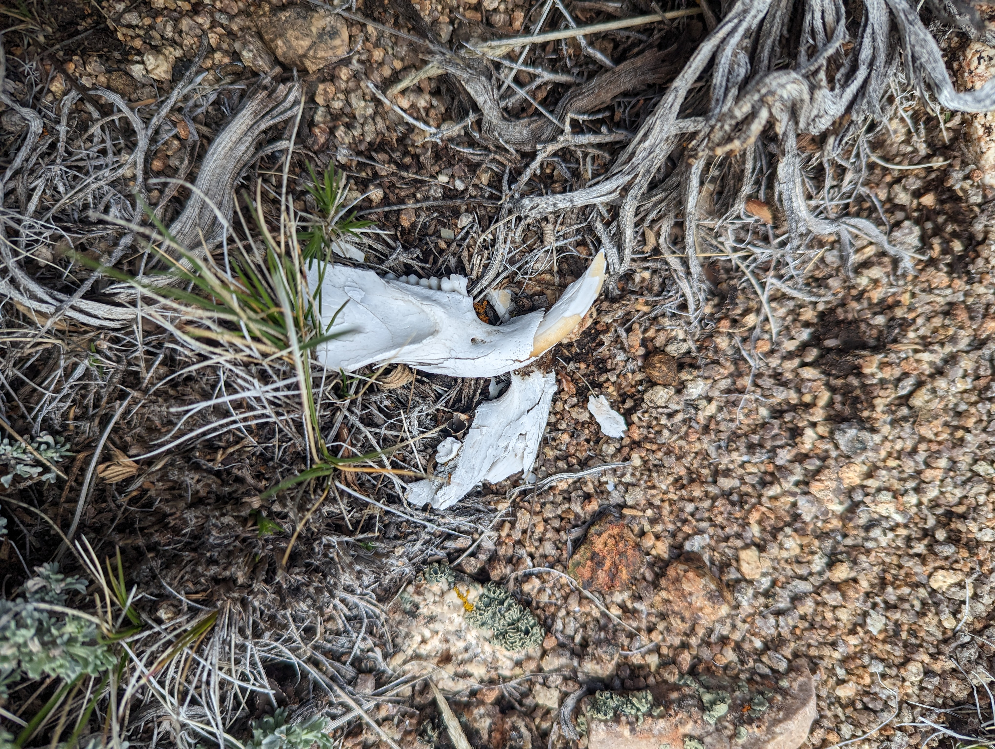 Some interesting bones, perhaps a cougar or a beaver?
The rest of the journey from here didn’t look too bad, I’d lose a trivial amount of elevation, cross a fairly large saddle, and then make the final push to the summit. I set off, making great time on some of the easier terrain of the day. A few times, I stopped when I noticed cool looking bones on the ground. I’ve seen my fair share of bones, but never so many so close to each other as Mt Siegel. The summit was now fully socked in with fog, giving it a pretty cool look. It didn’t really feel like I was in Nevada at this point with the way things looked.
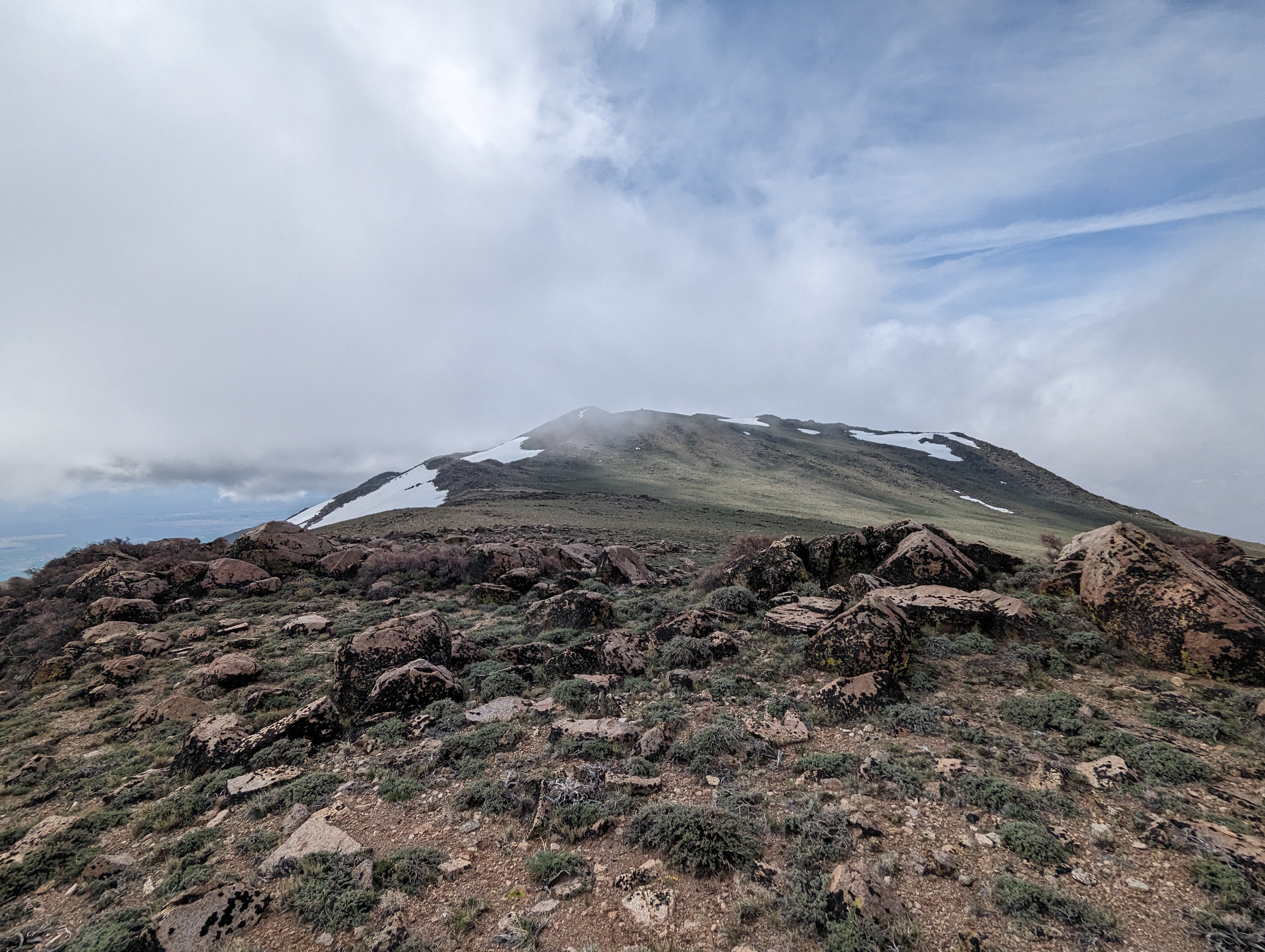 The last stretch towards the summit
Before long, I was at the last climb up towards the summit, and made it up quickly. I realized that I was closing in on 3 hours since I had started, and this arbitrary time limit made me move more quickly. There is a pile of rocks just north of the true summit that I felt might be higher, so I went up that just to be sure, before heading over to the large summit cairn. I summited at 10:13AM, about 2 hours and 52 minutes after leaving the truck. I snapped some pictures, signed the register, and transferred some gatorade into the bottle that I carry on my shoulder strap for the way down. After a few minutes of snacking and enjoying the view, I began my descent.
 Summit panorama
The descent proved to be pretty quick and easy by comparison. I opted to go east around point 9354, although I ended up having to cross a larger snowfield so that may not have been all that much more efficient. Once I cleared the larger granite, I was able to veer more to the east and pick up the pace significantly through more sandy soil, even jogging for sections where I could. I passed point 8595 in the same fashion, and made a great time down to the last point before the road. From here, I was forced to slow down a bit as there was a ton of downed trees and thicker brush. I started hearing engines down below me, and saw a truck emerging from the woods near where I had cut up to the ridge. The truck did not seem to be making much progress, so I went directly towards it just in case they were stuck and might need help.
 I enjoyed a bit of glissading on the way down
 Looking back down the ridge, the line of the fire is stark
I got down to the road and found that it was actually a group of 4 or 5 off roaders, slowly making their way through some very deep ruts and mud. We talked for a minute or 2, and I gave them what info I could about what lay ahead for them. They too were heading up Mt Siegel, although they intended to drive to the top. The rest of the road was fairly uneventful from there. The sun came out a bit more than before, although I never really felt hot. As I got closer, the 5 hour round trip marker started to creep up, and I again had an arbitrary time to beat. I hustled down the road and made it to the truck right at 4 hours 53 minutes.
 Washed out road on the way back to the truck
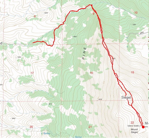
Route