OGUL #24 - Wade Benchmark
May 13th, 2023
I woke up early again for this one, we had enjoyed a nice dip in temps, along with some precipitation the previous week. I even got in a rare May pow day the previous Sunday. Looking at the forecast though, it was pretty clear that this Saturday was set to be significantly hotter. I wanted to knock another OGUL peak off, and initially had planned to go climb Mt Rose. I left the house around 3:15AM, and while driving over Echo Summit got the idea to knock Wade off instead of Rose, and save the hour of driving. I wasn’t entirely sure that the trailhead would be thawed out, but I had a feeling it likely would be.
Sure enough, when I got there the parking area was well thawed out. I parked the truck, strapped my skis in an a frame on my backpack, and set out to find the trailhead in the dark, it was around 5:15AM. I found the trail after a few minutes of stumbling around in the dark, and was soon making my way up some steep switchbacks. The trail immediately felt more like the Eastern Sierra than the Tahoe area. It was steep and rocky with plants that reminded me more of the desert than what you typically see in Tahoe. The switchbacks didn’t last too long, and soon they opened up into a route that goes directly up Horsethief Canyon. According to some research, it got its name because of the “horse thieves” who would steal horses from emigrants in Woodfords Canyon, and take them up Horsethief canyon to graze its meadows.
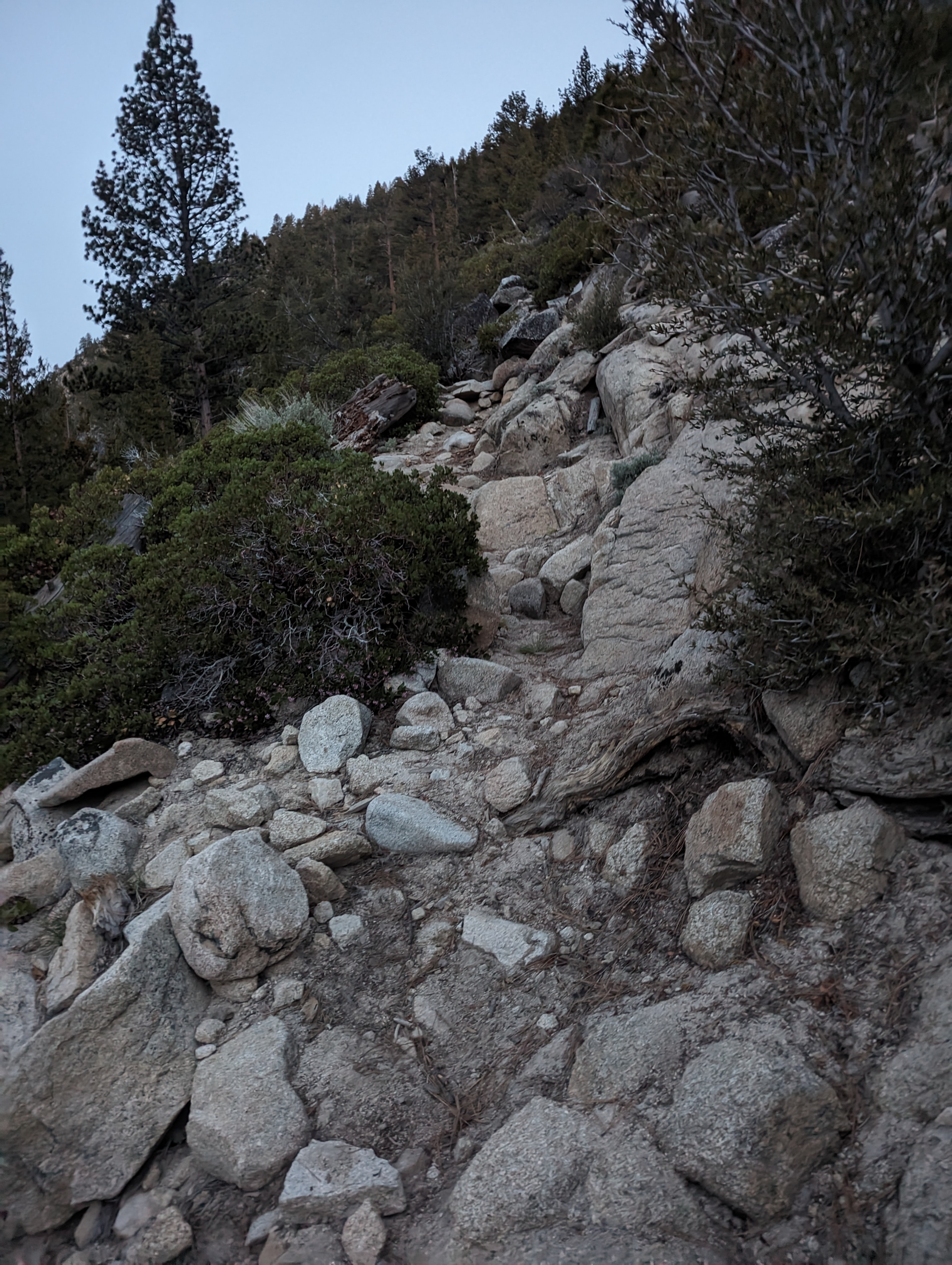 The rocky switchbacks near the start
The trail along the canyon was fairly steep, and soon crossed through a small grove of aspens. Not long after this, patches of snow started showing up. I was hiking in my crocs, and was pretty stubborn about not wanting to put my ski boots on yet. I took this a bit too far, and soon the trail was more snow than dry patches. My crocs did pretty well, but I started slipping more and more. I pushed this a bit farther than I really should have, and finally decided to acquiesce near the top of the steeper part of the canyon about a mile in.
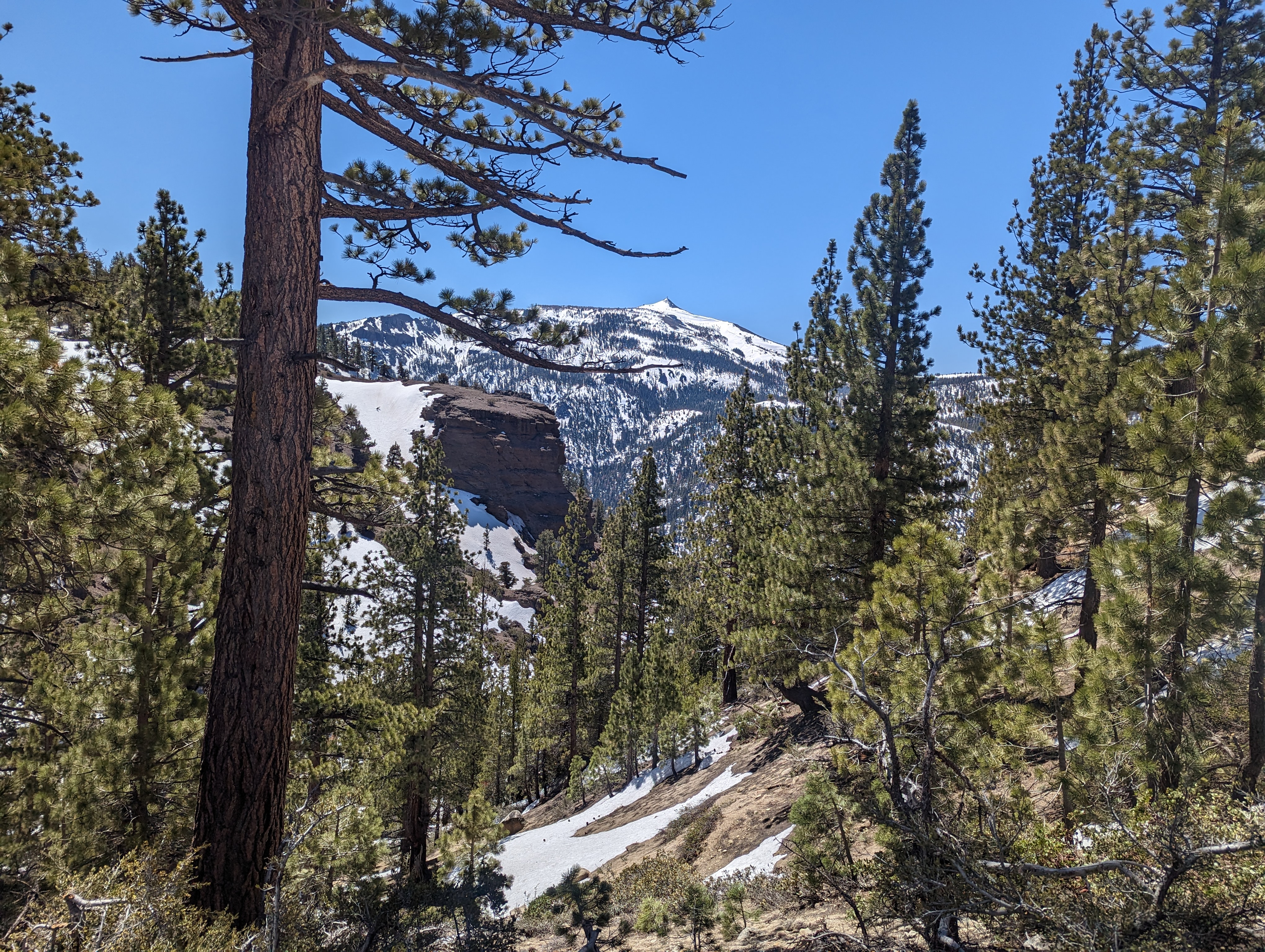
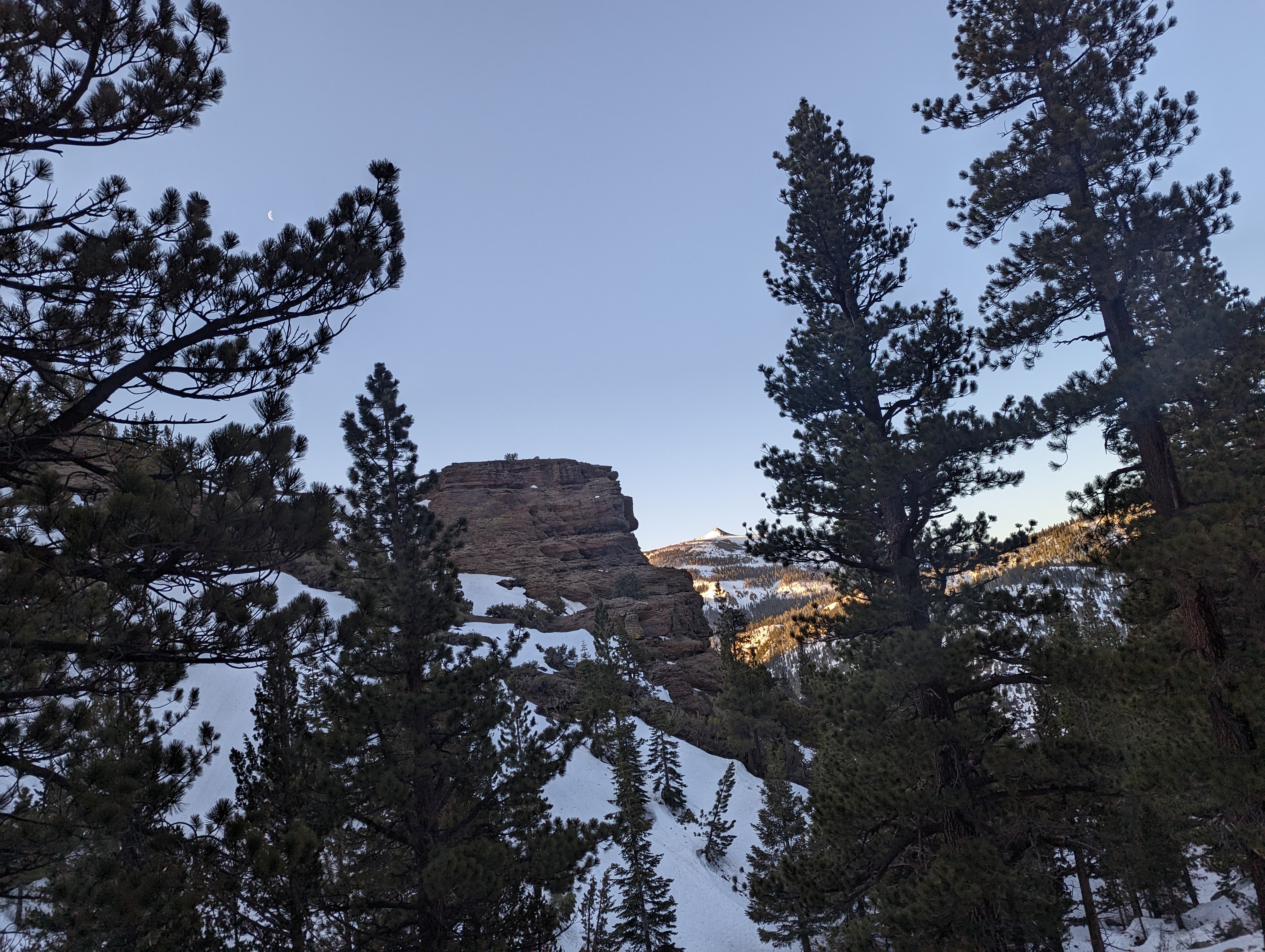 A cool volcanic feature and Hawkins Peak in the distance
After putting on my ski boots, I was able to make much better time than in my crocs. The snow was firm, so I was happy to just walk along in my boots for as long as I could before switching to skinning. The route grew a lot more mellow, and I continued along through some really nice old looking Ponderosa and Logdepole pines. Clearly this area has managed to avoid the logging that has taken place in most of California that’s accessible by vehicles. People say that logging prevents wildfires, but when you compare old growth to second growth, I think that argument falls flat on its face.
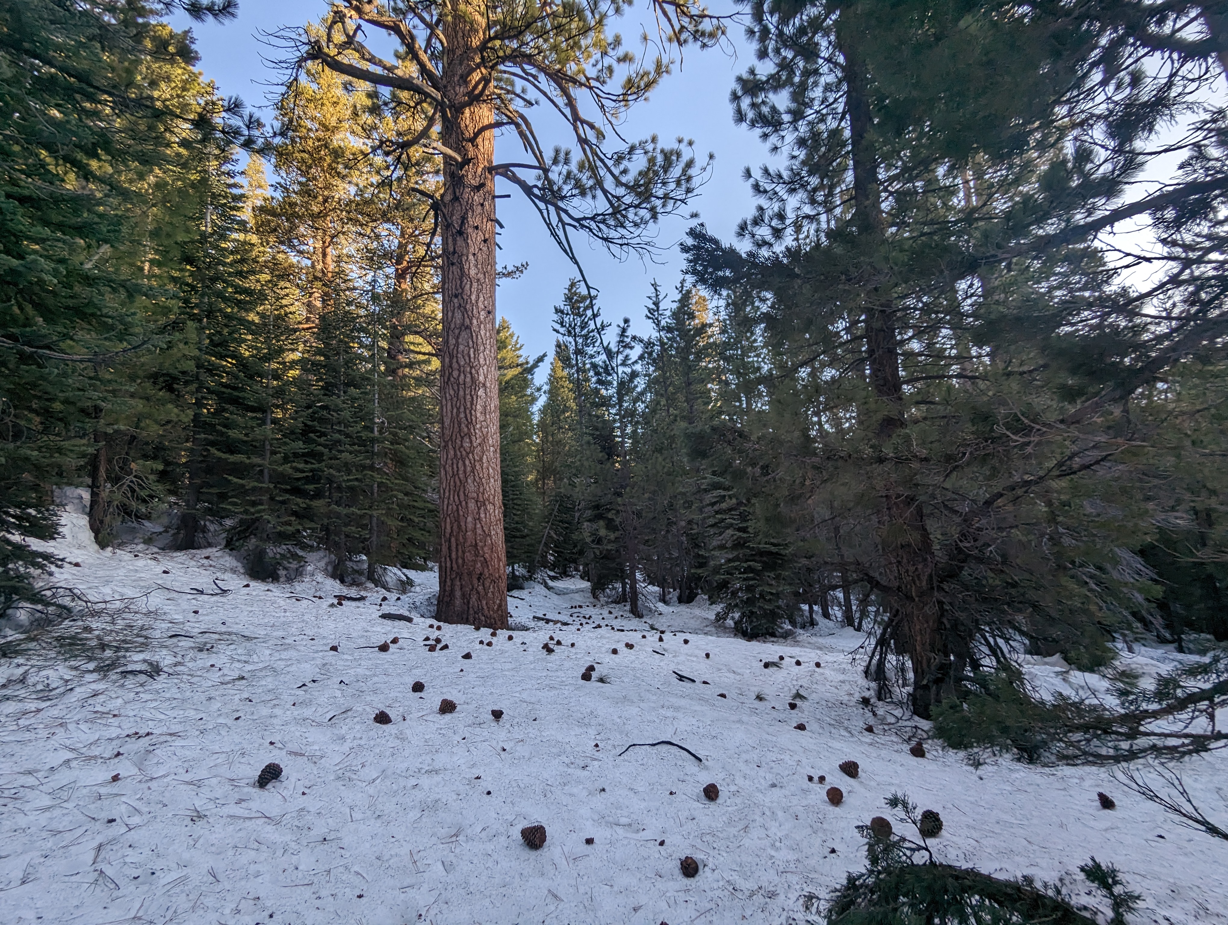 A large Ponderosa(?) Pine after the canyon flattened out
I continued along the west side of the creek through the woods for about 3/4 of a mile. After that, I crossed the creek near where I saw a road on my topo map and started making my way up a long ridge. The ridge had some monster Juniper trees, which are some of my favorite trees. They just seem wise to me for some reason, they’re never the tallest, but they can be stout. Somewhere around ~8200 feet, the grove of Junipers eventually gave way to a long, low angled opening that continued up towards the top. The snow here was still surprisingly smooth, and I started to realize that I might actually get some good turns in. I had resigned to this just being a long walk through the woods, but I’ll always take good snow if its available.
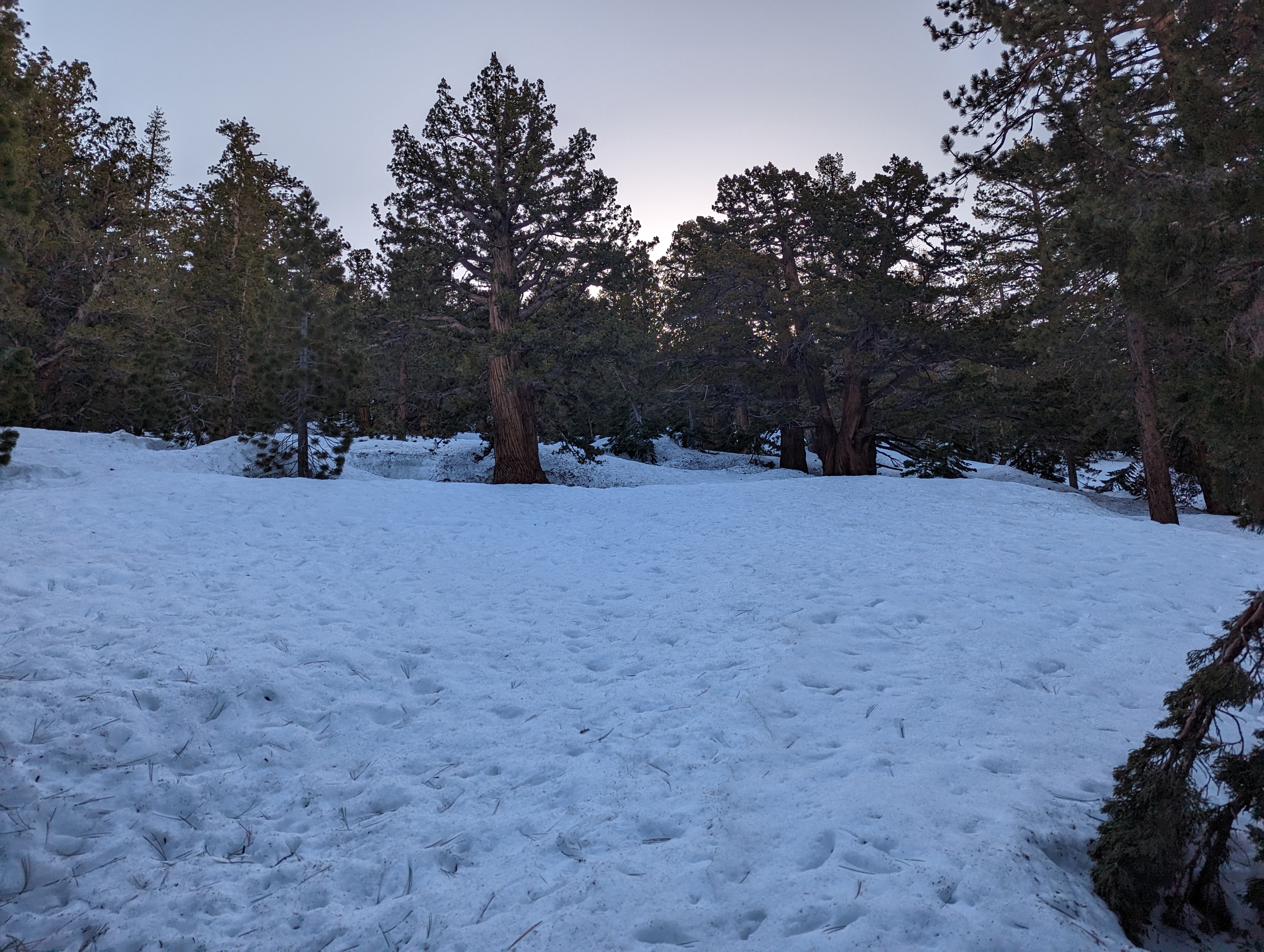 Junipers on the east slope of the canyon
After perhaps an hour, I topped out on the ridge around 9200 feet, and finally decided it was time to switch to skinning as the snow on top was getting softer. Once I started skinning, I realized I started debating whether or not it would have been more efficient to have switched over sooner. Regardless, I was making good time across the relatively flat ridge top. Even though Wade was less than 200 vertical feet higher, I still had about 1.2 miles to go. This was fine with me, as the views from the area were incredible, and I had the whole place to myself.
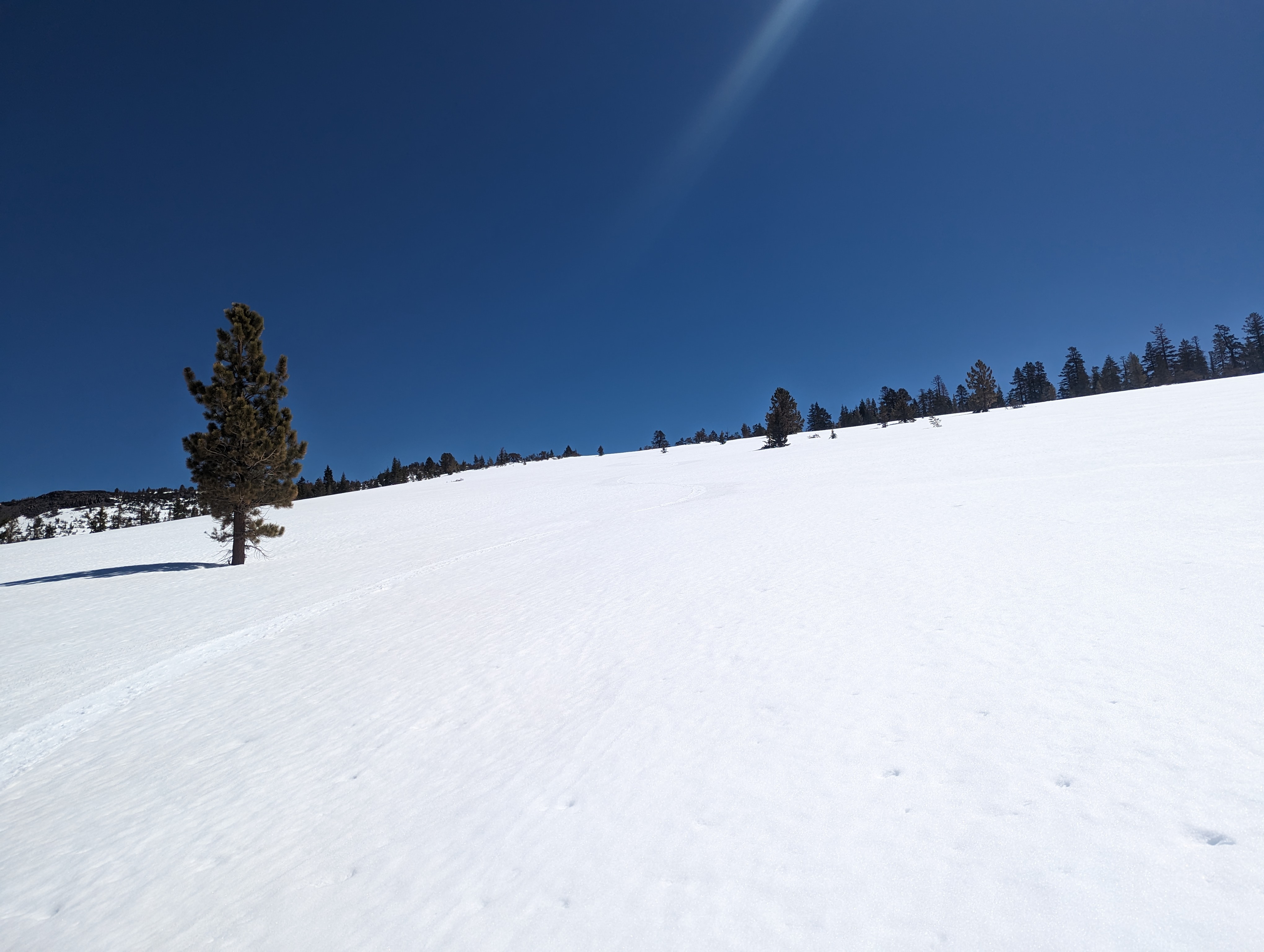
 The gentle open face leading up the ridge
 Looking back towards Carson Pass from ~9000ft
After a bit, I went under a really cool looking volcanic rock feature, the whole day really felt more like I was in the southwest than the Tahoe area. Not too far beyond that, Wade came into view, and I saw that there would be a bit of a downhill to get to Wade. I came up to a cornice that was about 10’ tall, and managed to side slip down it with my skis, and did my best to stay on the highest point possible connecting the 2 points. Before long, I was at the base of the summit block of Wade. I dropped my skis here, and made a short bushwhack/rock scramble to the top.
 Another cool volcanic feature
The views from the top were spectacular. I could see the whole Carson pass area pretty well, down into Gardnerville, northeast towards the Freel-Job’s ridge, and the Ebett’s pass area to the south. I signed the register, and was surprised to see nobody had signed it since October of last year. There was another older register box, and unfortunately the contents were mostly ruined by water. However, I did see a signature from 1989 which was pretty cool. I hung out for perhaps 10-15 minutes, and started making my way back down. Once I got back to my skis, it was pretty smoooth sailing back to the top of the ridge I had ascended that morning. I stopped here for a good 20 minutes to take my ski boots off for a few minutes and enjoy a nice snack break.
 Panorama from the top of Wade
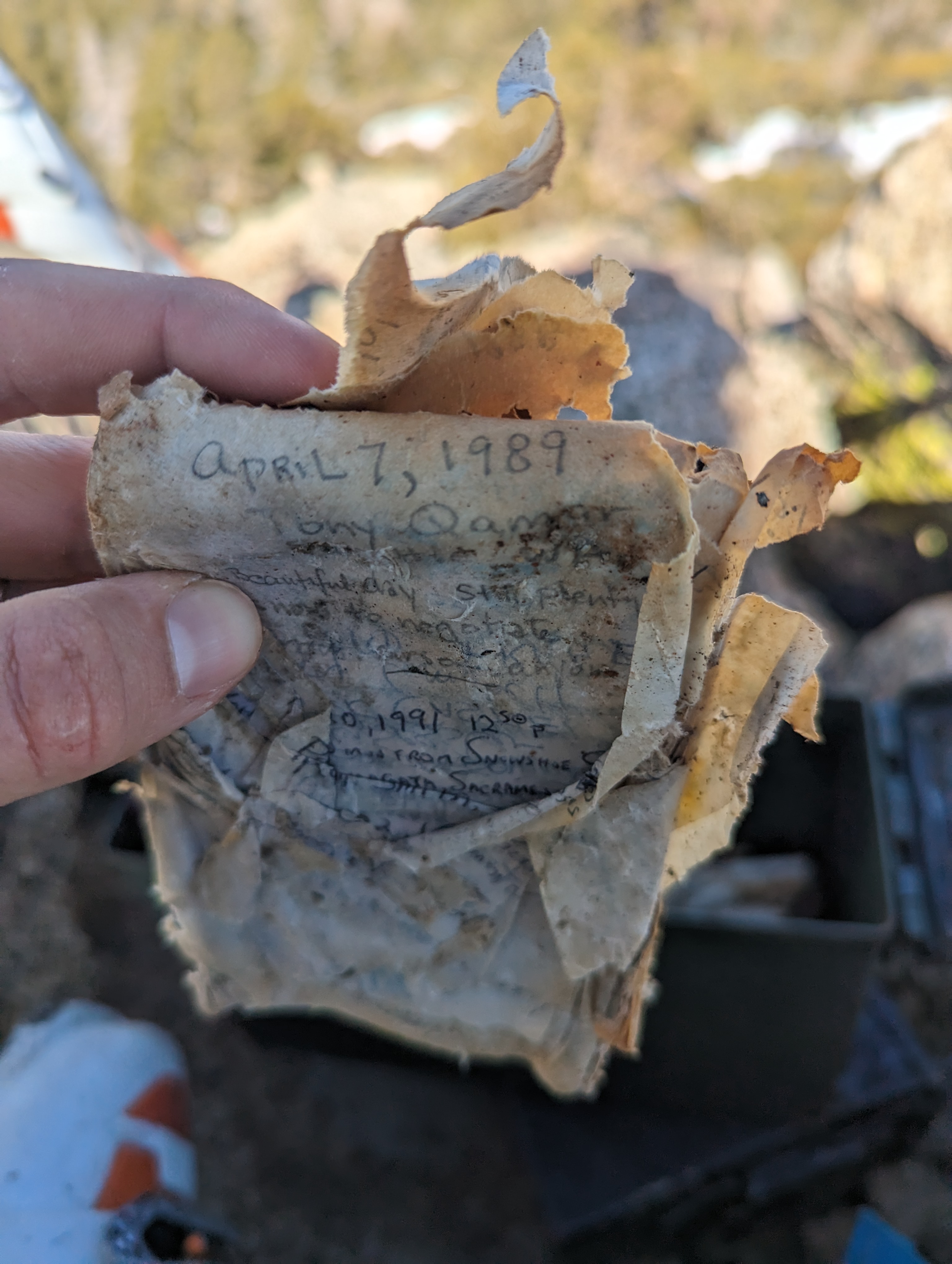 What remains of the old register
After eating, I transitioned my splitboard and took off down the ridge. I knew it was really easy going terrain, so I had opted to leave my helmet this time. Of course that meant I forgot to take off my hat, which flew off within 15 seconds or so of starting off on my snowboard. I made the annoying hike back up to go grab it, and then set off again. The corn was perfect, and I enjoyed some awesome, wide open turns for a bit, before coming to a wall of trees a lot sooner than expected. I checked the map, and I had veered a bit in the wrong direction, and was going down a different drainage. I unstrapped, and hiked across the slope back towards the way I came up (perhaps a few hundred yards at most). The snow was still perfect over here, and I flew down about a mile in just a few minutes.
 Mellow turns back down to the creek
I crossed the creek a bit southeast of where I had crossed in the morning, but still had no issues. I put my headphones in, and listened to a podcast as I worked my way back through the forest. After about an hour, I was back at the top of the Canyon. I was a bit higher than my approach, so I had to walk down some fairly steep dirt. On my way down, I found an old mini shovel which I packed out. Its technically litter, and I can use the shovel. Win win. I made it back to my truck around 12:20 or so. My GPS stats said it was about a 9 mile journey that took just a few minutes shy of 8 hours.
 One last view of Hawkins peak and the before descending
I can see why this isn’t a super popular peak to hike, its not very prominent, and there are a ton of other cooler looking peaks nearby to draw you away. That said, I’m glad this was on the OGUL list as it forced me to go have a really nice tranquil day in the woods. I didn’t see another soul while I was out there, and the scenery was fantastic in more than one way. Definitely give this peak a try if you’re looking for a nice easy ski and some solitude.
Route
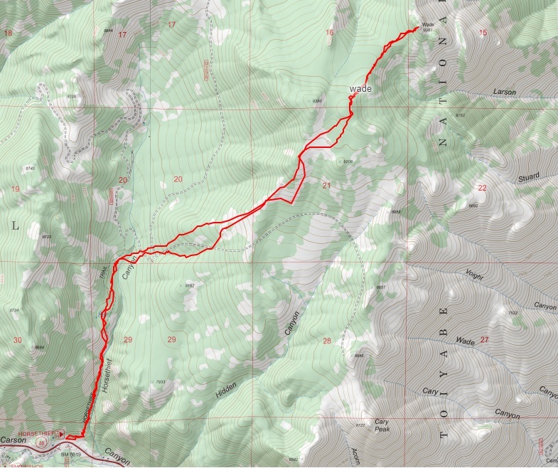 My route
GPX Track Download
My route
GPX Track Download