OGUL #31 - Adams Peak
June 24th, 2023
I planned this trip on a whim the Thursday before we went. Adams Peak is the furthest north of any peak on the OGUL list. I’ve been trying to knock out some of the furthest ones so I can eventually just have ones near Tahoe left, plus a lot of options are still unavailable to me after the insane winter we had. I wanted to go for a quick overnight camping trip with my wife and my dog, and Adams seemed to check all of the prerequisite boxes, so I took off work a few hours early Friday, and we started the drive up.
We drove up through Reno, and stopped at the In N Out Burger there for dinner. We got George a pup patty (a plain unsalted patty), and made sure to give it to him in small pieces so that he’d actually savor it and not just demolish it in 3 seconds. All 3 of us enjoyed the meal, and continued up north on 395, a stretch of road I’ve never been on. We drove for another half hour or so, and stopped at the Red Rocks trailhead, where I had read there were some dispersed camping areas. We found a decent spot to camp, and took the short walk up to the Red Rocks themselves. After spending a bit enjoying the cool formations, we walked back down to the truck, and decided to move it up the road a bit closer to camp for the night.
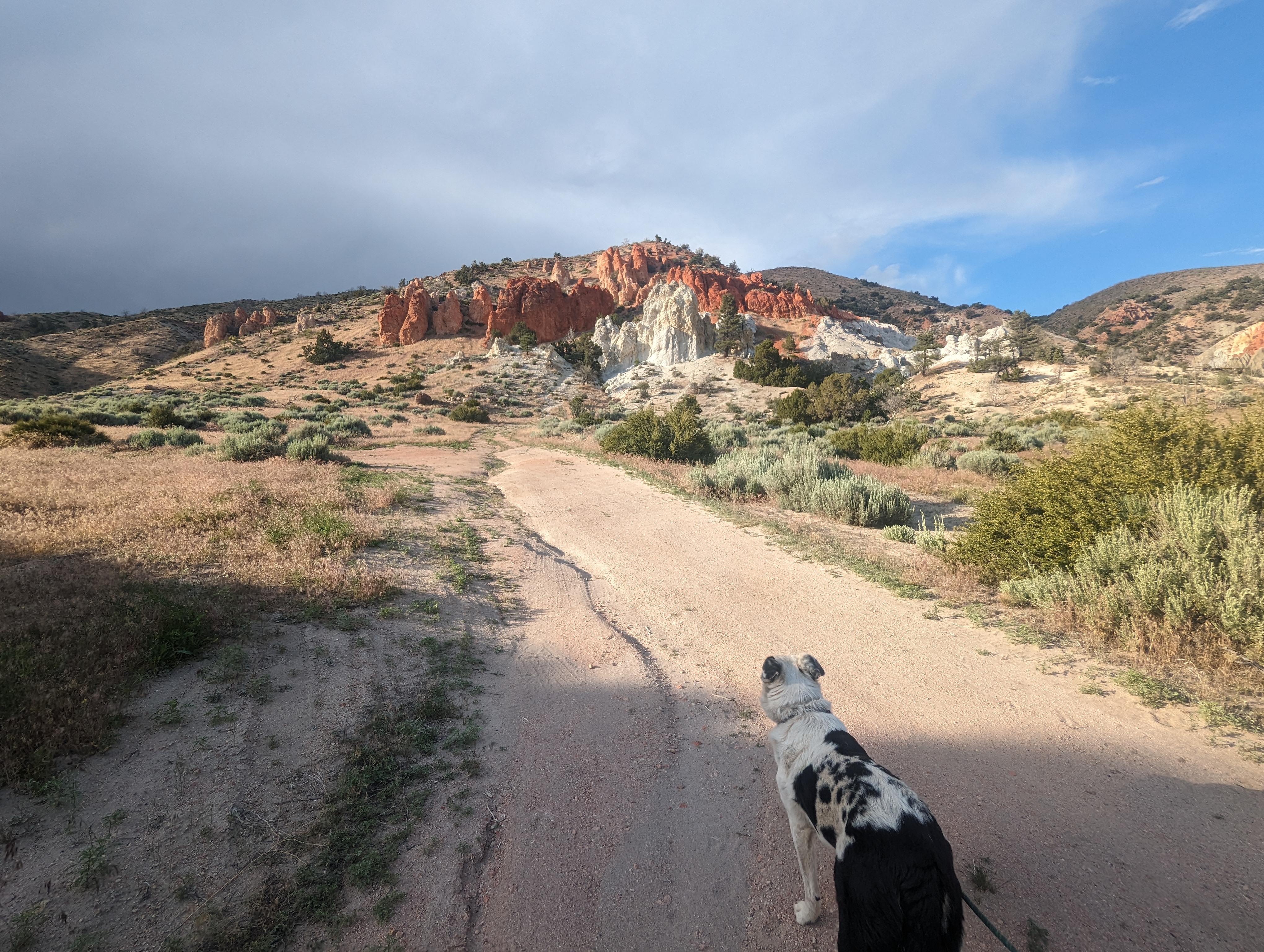 George and the Red Rocks
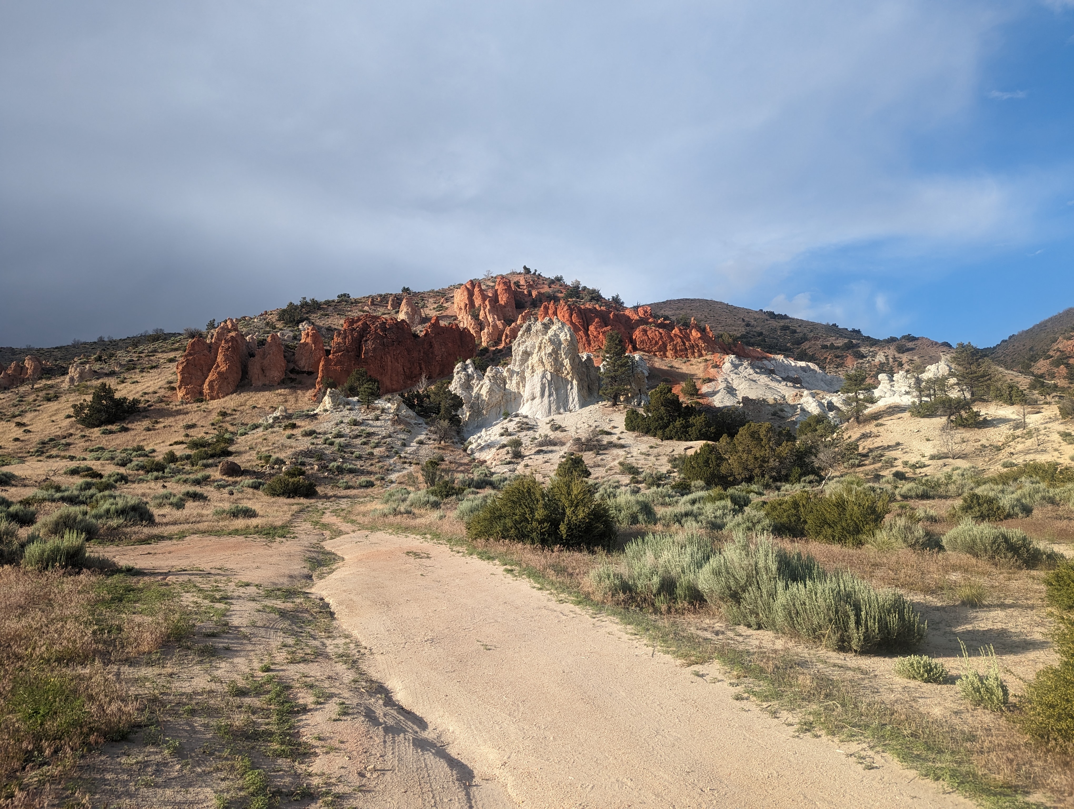 Red Rocks
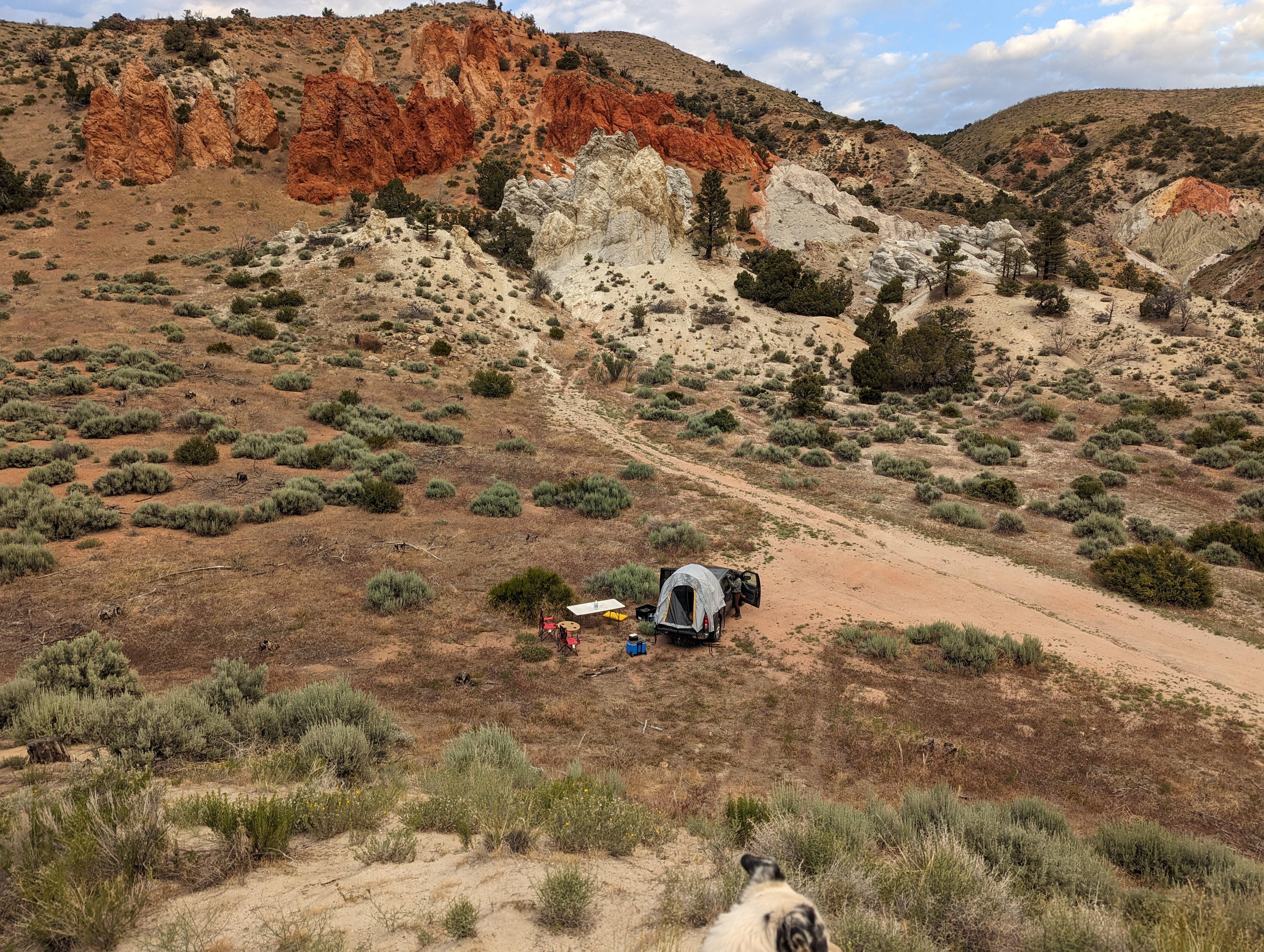 Our Campsite
I let myself sleep in Saturday, but we were both up and moving by 6AM or so. We broke camp, and made breakfast burritos to fuel our easy hike. George discovered that they had sticks up there, and occupied himself chewing on and burying them, we even threw a couple for him which is his favorite thing in the world. Once we were packed up, we got in the truck and started driving to Frenchman Lake. The lake looked nice and full, we drove towards its east side, and onto a network of dirt roads.
I had gotten some GPX files of the drive from Peakpagger, which made the drive pretty easy to navigate. We did have to overcome a few very deep rutted muddy sections, but were able to get around them without too much issue. Near the start of our hike, we encountered a large tree down in the road, which I managed to also get around with just a few inches to spare. On the way back, the tree had been miraculously cleared from the road by somebody, prompt service in the Plumas National Forest!
We arrived at the trailhead, geared up and started the hike. After 3 or 4 minutes, I checked my caltopo app only to realize we were heading down a dirt road that didn’t go anywhere near the peak. We turned around, and made it back to the truck to find the proper dirt road to follow. The dirt road we walked was barely a road, more of a glorified dirt bike trail perhaps, it had teenaged trees growing right in the middle of it. Clearly nobody had driven this thing in over a decade in a full sized vehicle.
 Looking up towards Mt Adams near the start
The entire area was burned quite severely in the 2021 Beckwourth Complex Fire. It seems like in most areas basically all of the trees died. It’s quite sad to see, but it is cool to come back a few years later and see how quickly other plants fill the void. The wildflowers were extremely abundant, as well as the mushrooms. We crossed over a small creek, which was right around where the “road” fizzled out. George got in the creek and splashed around for a bit, and we continued on, heading to the east of the small peaklet (about 7600’) north of Adams. The terrain got pretty steep here, and despite the hike being short, it was a bit tedious walking along the side of the hill here.
 One of the many types of wildflowers we saw
Before long, we crossed another, smaller creek separating Adams and its northern neighbor. George tested the waters again, and we decided to continue hugging the east side of Adams as it looked marginally less steep. The dead trees eventually gave way to more granite, and the summit became more and more apparent the closer we got. Around this time, George seemed to get a bit tired, and started pulling more across the hill than straight up it. I encouraged him along the last little bit, and we topped out together right around 10:15 AM.
 George in the second creek
 Summit Panorama
Looking to the east, it seemed that the subpeak in that direction might be slightly higher. I had done very little research, but knew that, according to the forest service topo map I had loaded, this was the peak. The USGS marker and nifty aluminum summit register seemed to confirm this. When I returned home, I learned that the east summit may indeed be a few feet higher. The OGUL list seems to indicate that the west summit is what counts for the list, but I’ll still likely come back and ski it just because it bothers me to not stand at the “true” summit. It sounds like the peak was declared incorrectly at some point, and those USGS markers aren’t easy to move.
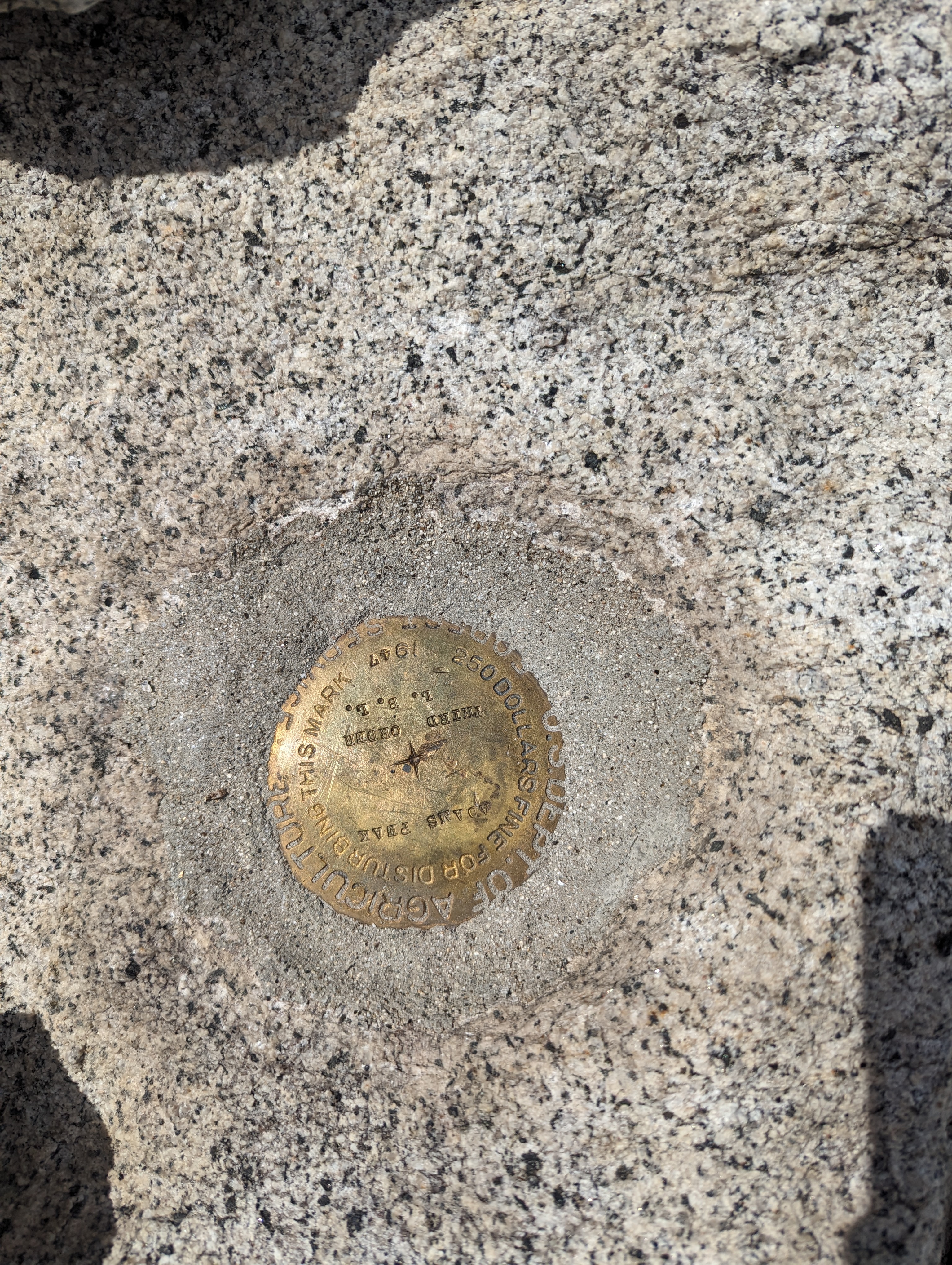 Summit Marker
The register dated back to 1972, and seemed to be made of cast aluminum. I had never seen this design before but it seemed to be quite sturdy and weather resistant. We both signed the register, and took some pictures. We had nowhere important to be, so we spent a good 20 minutes on top enjoying some snacks and the views. Lassen was visible to the north, as well as Honey Lake. I couldn’t really determine what many of the other visible peaks were from the unfamiliar area, but Caltop’s viewshed layer told me that the tops of some other OGULs (Mt Rose and Siegel) were visible to the south.
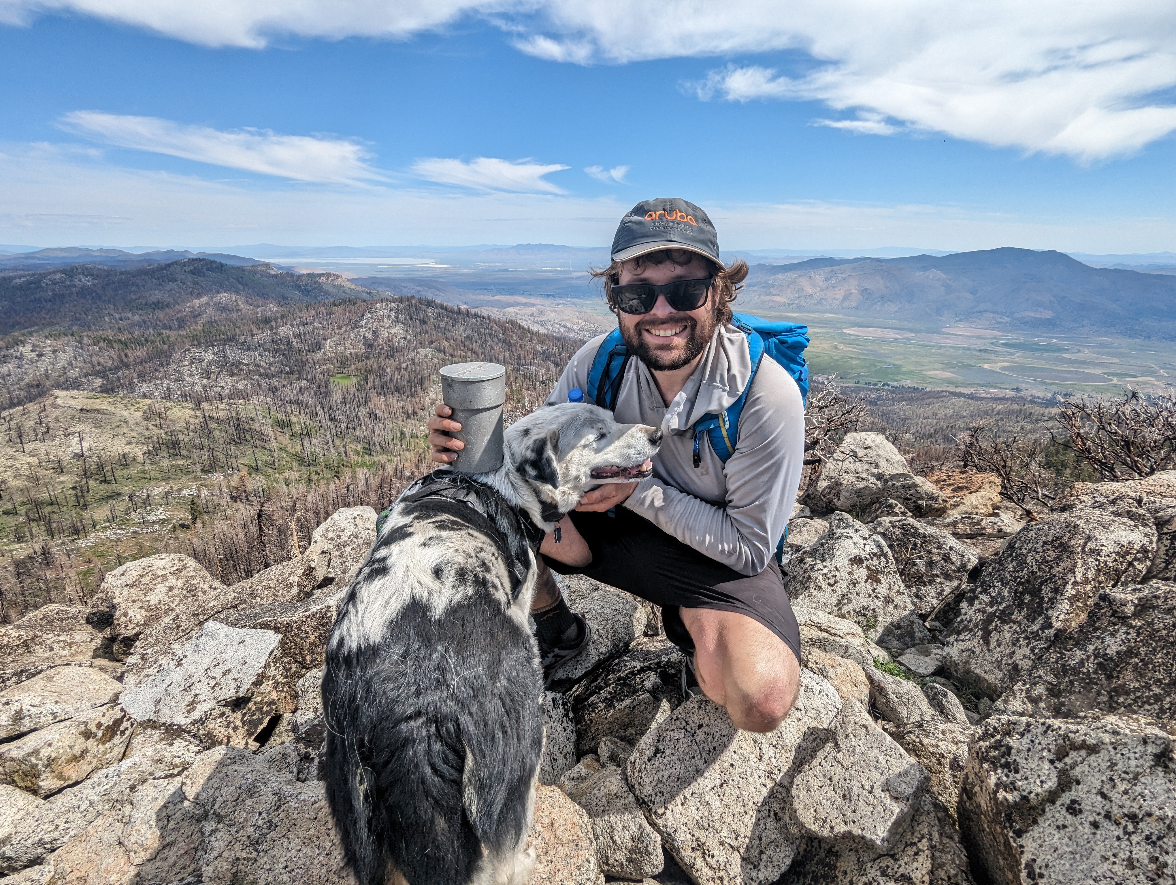 Me and George on top, the summit register is in my hand
On the way down, we took the west side of the peak because it looked a bit more mellow, and to spice up the scenery. At first it was a bit of a bushwack through some charred, but still quite strong bushes. After that, it was just like the way up. Dead trees and low shrubs with lots of wildflowers mixed in. I have read that this was a bushwhack before the fire, and I would imagine it will be again in just a few years. With the huge winter we got, it really felt like this was a special June to be on this peak. It felt like we were there right at the peak wildflower bloom.
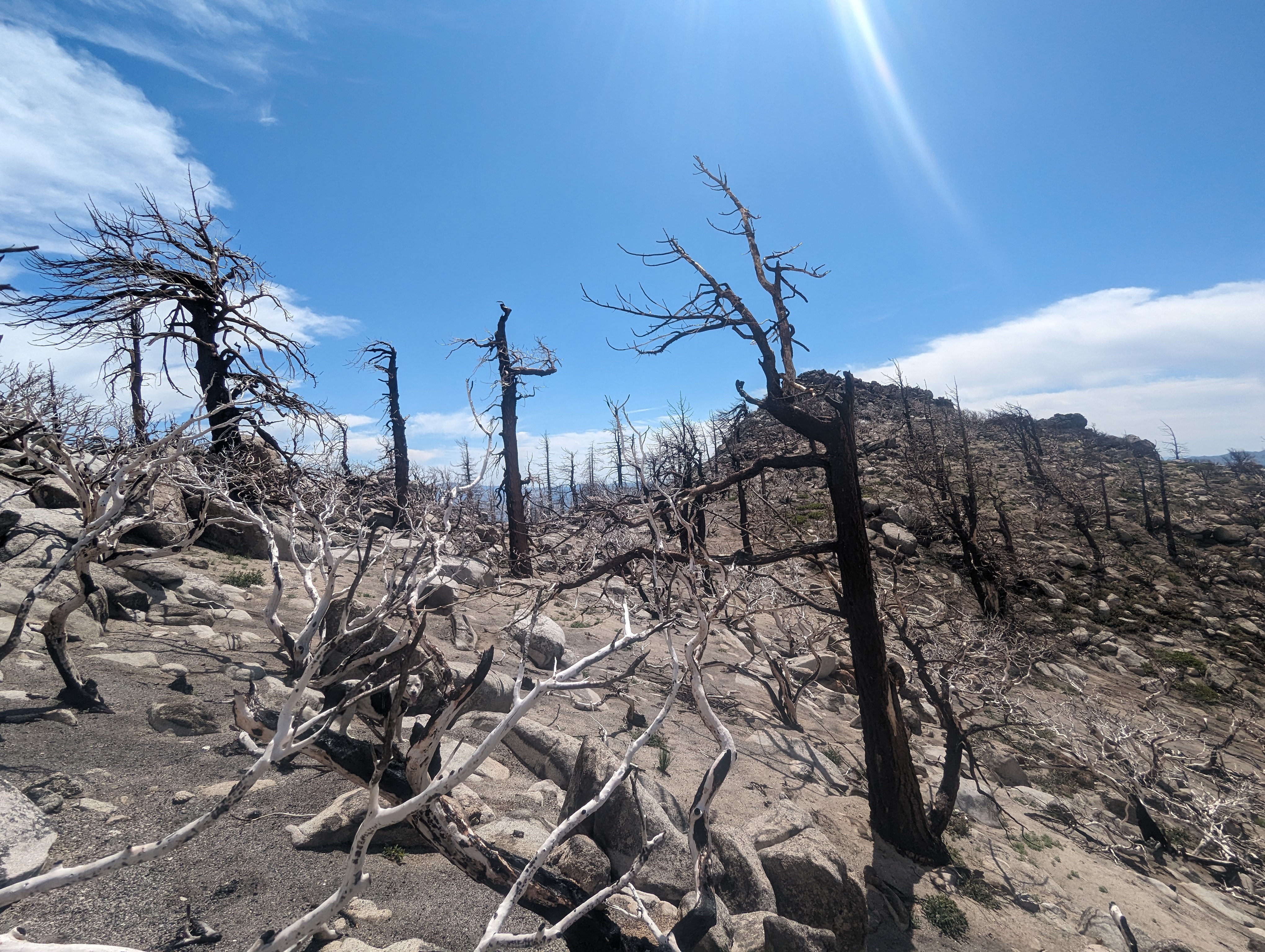 Burned trees and bushes on the way down
We traversed a bit closer to the peaklet on the way out, and made our way back down to the first creek in good time. What seemed like the remnants of a steep road led us straight down the canyon into a short section that was quite boggy. We both managed to get our feet wet, and George ran off to the creek to get his whole body wet. A few hundred yards downstream we were able to pick up the “road”, and followed that back down to the proper road, this time we seemed to go in a slightly different direction. I think there are probably a lot of things that seem like roads out there that may or may not actually be one. We got back to the truck around 11:45 AM and made the long drive back down along the dirt road.
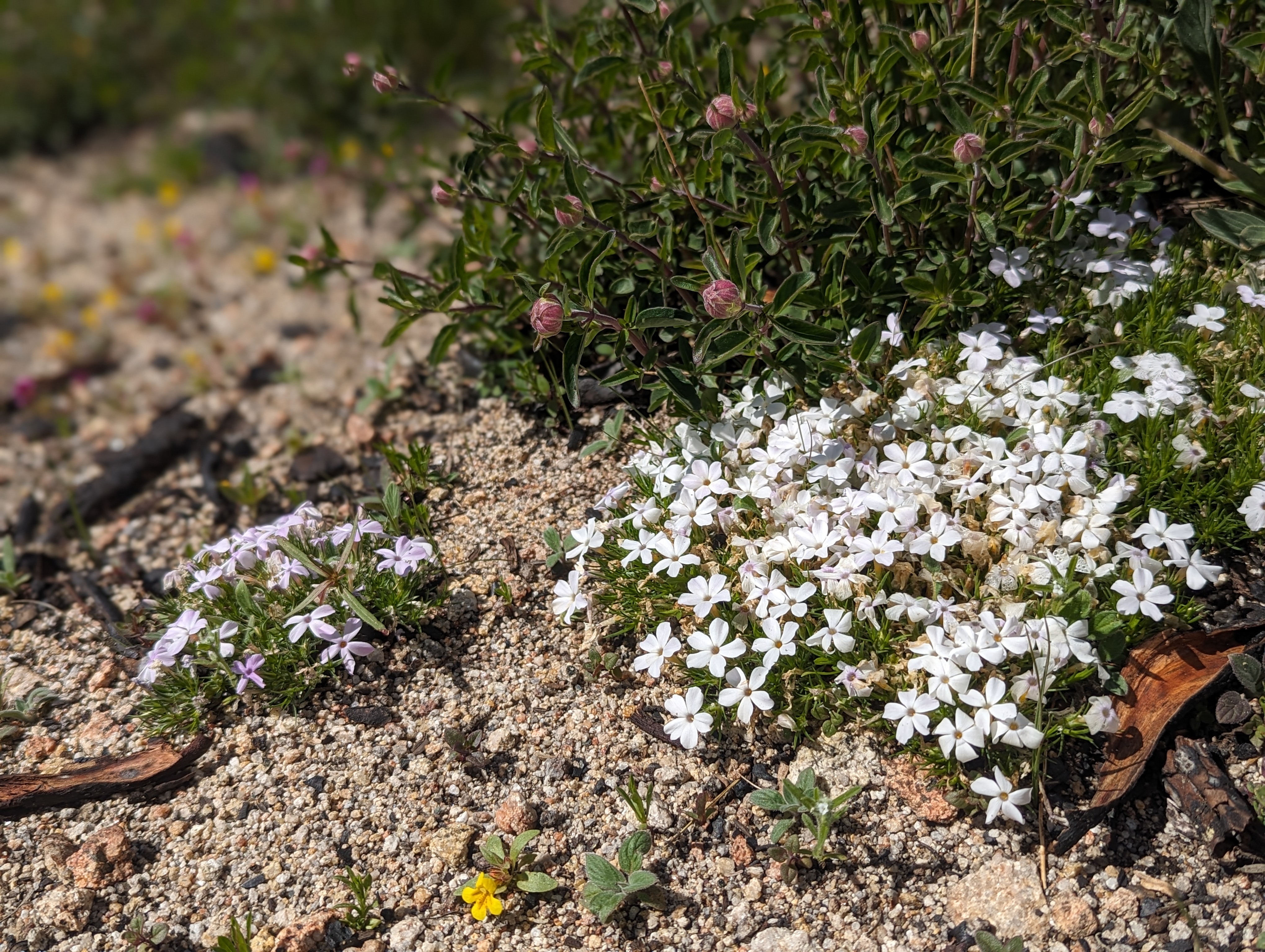 More wildflowers
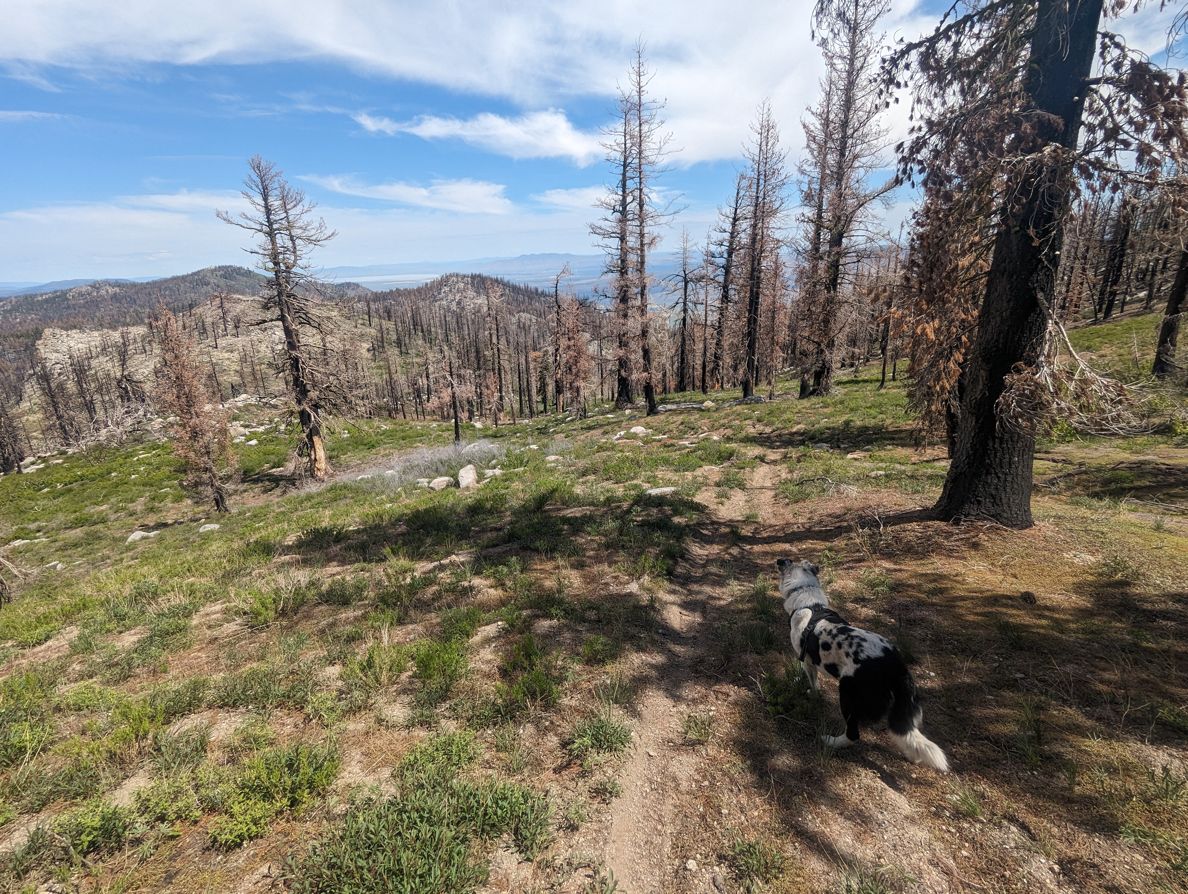 George leading the way back
Some of us enjoyed the creek more than others
We stopped in Sierraville for some Mexican food on the way home, unfortunately they don’t have a dog menu, but George was fast asleep in the back seat. Instead of taking 395 through Reno, we opted for highway 89 back to Truckee, which neither of us had ever driven before. The drive was quite pleasant, everything was still very green. In Truckee, we made one last stop at the Donner Memorial State Park, we had a Poppy Pass and figured it was worth checking out for a few minutes. The drive home from there was uneventful, and we made it back with plenty of daylight to spare. Not bad for an impromptu Friday night camping trip.
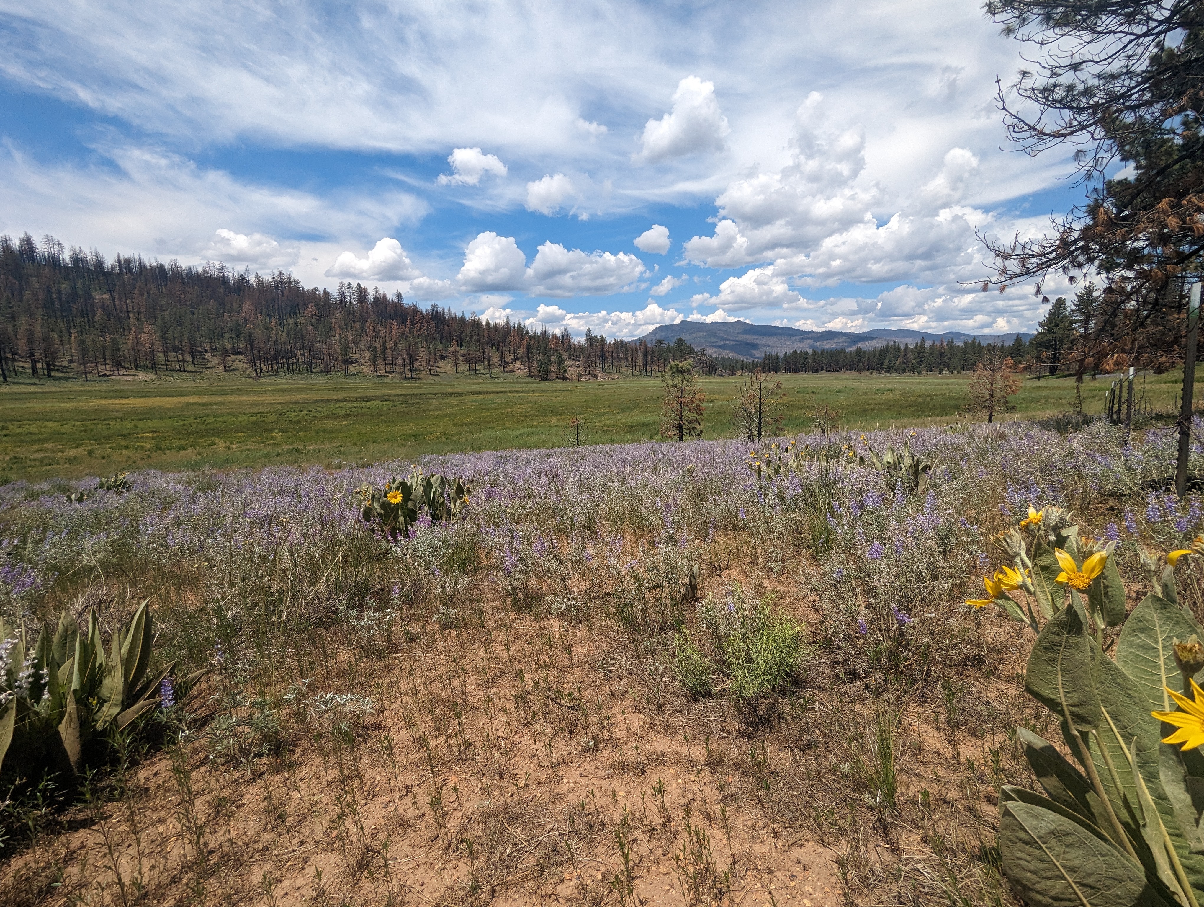 The lupines were in full force on the drive out
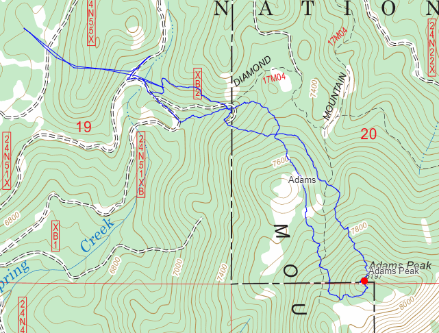
Route
Something weird happened with my Caltopo App and it went a bit crazy at the start, creating some erratic lines